 5.0 Excellent

Dorine M1 year ago

Grateful experience
As a solo female traveler, I felt super safe and well taken care of the entire time.
Read more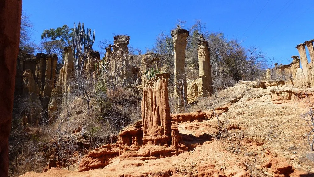
Southern Circuit
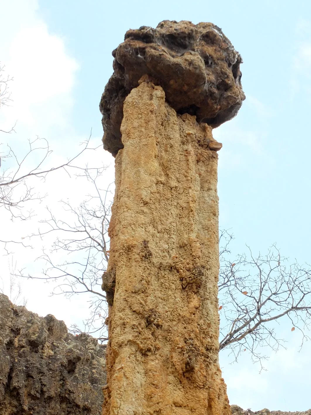
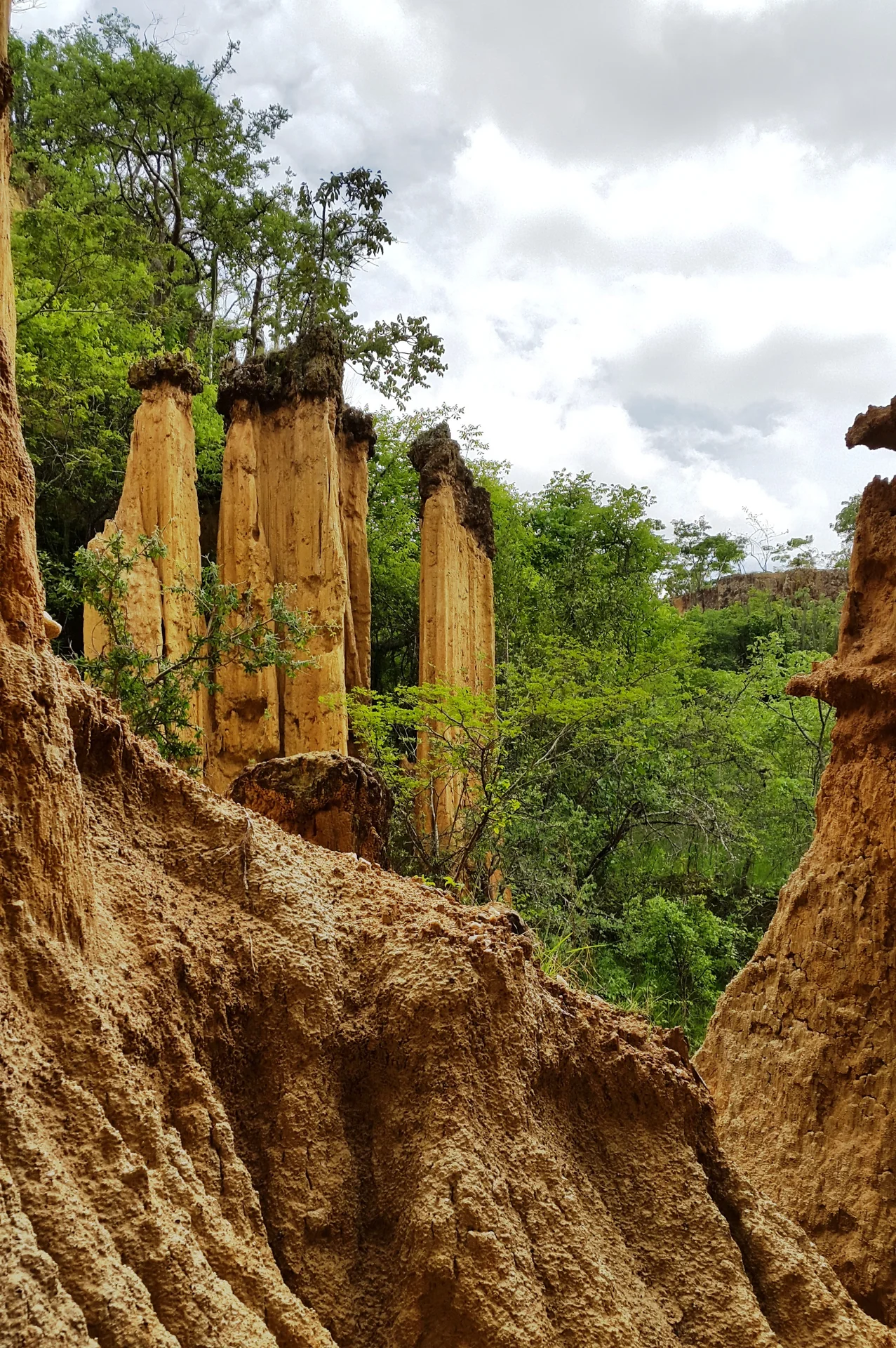
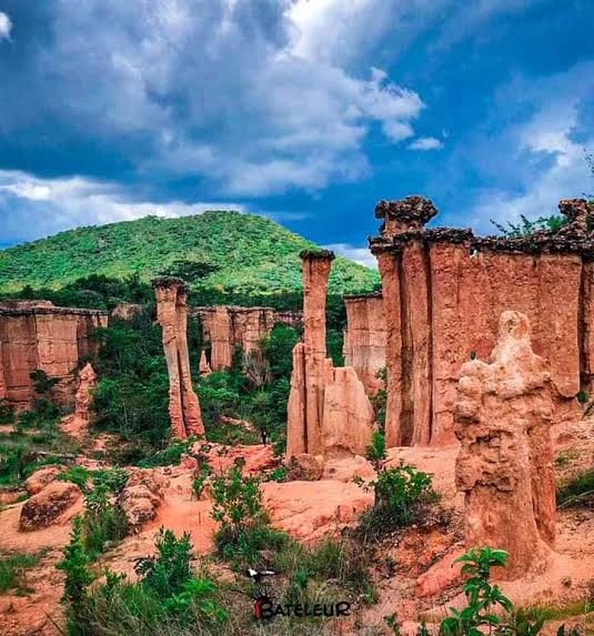
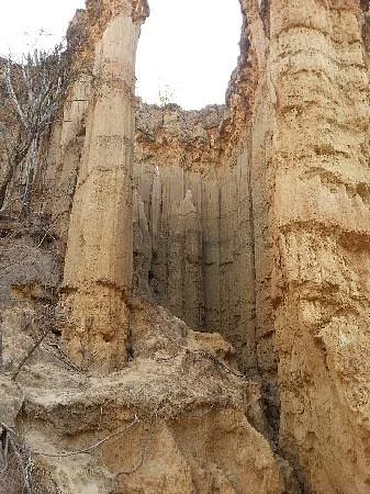
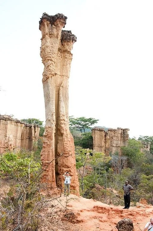
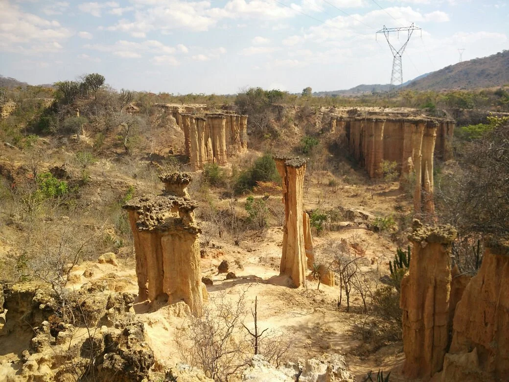
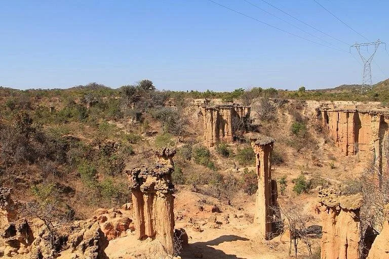
Isimila Stone Age Site — Archaeology and Natural Pillars near Iringa Isimila Stone Age Site brings together two compelling reasons to explore Tanzania’s Southern Highlands: evidence of early human tool-making and a landscape of towering natural pillars. Near Iringa, gullies cut into the ground reveal layers of sediment and a remarkable archaeological record. A guided visit helps connect what you see in the landscape with the people who once worked stone here, turning an attractive walk into an encounter with a much deeper past. This is a rewarding destination for travellers who enjoy history, geology, outdoor photography and learning through exploration. The contrast between the scale of the pillars and the detail of a stone tool is especially memorable. Give yourself time to appreciate both. A comfortable excursion from an Iringa base can introduce a cultural dimension to a southern safari or become the centrepiece of a day devoted to the region’s heritage. Location and Heritage Status Isimila lies in Iringa Region, south of Iringa town, approached from the road towards Mbeya. It is commonly planned as an excursion roughly 20 kilometres from town, with distance varying according to the starting point and route. The setting is a highland plateau rather than a lowland wildlife reserve. Ask your organiser to confirm the site entrance and final approach when arranging transport. The Ministry of Natural Resources and Tourism lists Isimila as an Early Stone Age site with natural pillars, covering 32 hectares and protected under Government Notice 116 of 1958. TANAPA includes it among the cultural heritage sites it manages. These protections reflect its archaeological importance; they do not make it a national park or imply that ordinary wildlife safari activities are available within the site. The Stone Tools and Why They Matter Isimila is celebrated for a dense record of Acheulean stone technology. Handaxes and cleavers are particularly important, alongside flakes, cores and other implements. The tools were shaped by removing pieces of stone, leaving working edges and recognisable forms. With interpretation, an object that first looks like an ordinary rock can reveal decisions about material, shape and manufacture. During a visit, ask how a deliberately worked stone differs from a naturally broken one, what a core tells us about production, and why large cutting tools attract scientific interest. Tool form can suggest possible uses, but an exact task cannot always be proved from shape alone. A guide can explain these distinctions and the role of the material’s original archaeological context. A Changing Understanding of Time Isimila’s archaeological record extends back hundreds of thousands of years. It should not be reduced to one fixed date for every tool or sediment layer. Research revisits the relationship between the deposits, the artefacts and evidence from other dated sites, and estimates have changed as new methods have been applied. A 2023 reassessment proposed a broad age range of around 500,000–900,000 years for the lower Lukingi deposits, based on faunal comparisons and preliminary electron spin resonance estimates. Those estimates concern particular deposits and are not a precise age for every object visitors may see. Other research has investigated luminescence dating and the sources of stone used in tool-making. The most useful visitor explanation connects the evidence with its uncertainties rather than promising a single birthday for the whole site. The Natural Pillars and Canyon Landscape The pillars are natural erosion features. Water and weathering have cut into the sedimentary ground, removing material unevenly and leaving columns, narrow ridges and steep faces. Some towers retain more resistant material above softer sections, producing distinctive shapes. Their colour and texture, combined with changing light and vegetation, make the gorge an engaging place for landscape observation. Notice the layers exposed in the sides of the gullies and how the shape of a pillar changes as you walk around it. The landscape continues to evolve, so the current walking route is more useful than an old map or a fixed promise about which formation will be accessible. The pillars are geological features, separate from the tools made by early people; appreciating that distinction is part of the visit. How a Guided Visit Can Unfold Begin with the site’s archaeological introduction and any interpretation displays open at the time of your visit. This gives meaning to the tools and deposits before the walk. Ask which parts of the archaeological area can currently be viewed and how the pillar route will fit the interests and walking ability of your group. Continue along the approved route into the gorge with the guide, allowing pauses for explanations and photographs. The descent and return ascent are part of the experience, so comfortable pacing matters. Rather than treating the pillars as a quick photo stop, take time to compare their shapes and discuss how erosion both exposes archaeological evidence and creates conservation challenges. Allow around two to three hours at the site as a planning estimate, and a half-day from Iringa when transfers and breaks are included. The actual duration depends on which areas are open, your chosen route and your pace. Confirm the programme before combining it with a long drive or another timed activity. The guide may adapt the walk to local conditions. Walking Conditions and Who Will Enjoy It The gorge walk involves uneven ground, slopes and exposed outdoor sections. It suits visitors comfortable with a moderate walk, while the exact demands depend on the route chosen. Wear closed shoes with a good grip and bring drinking water. A hat and sun protection are useful, and a light layer can make cooler highland mornings more comfortable. Families can make the visit engaging by asking children to compare tool shapes, identify sediment layers and explain how a pillar might have formed. Keep children close to an adult near drops and fragile formations. Tell the organiser about limited mobility, knee problems or other walking concerns beforehand. Access to interpretation areas and access to the gorge should be assessed separately; do not assume the whole site is step-free. Photography and Learning Activities Isimila’s pillars offer opportunities for wide landscape photographs and closer views of layered surfaces. Take images from approved paths and ask the guide where stopping is suitable. Softer morning light can be helpful for photography, but access hours and current conditions determine the visit. Personal photography, video and commercial work may have different requirements, so check before arriving with specialised equipment. A notebook or sketchbook also works well here. Record the questions raised by the tools, draw a sequence of layers or compare silhouettes of several pillars. Teachers and group leaders can plan themes around early technology, environmental change and the preservation of archaeological evidence. Any practical demonstration, research session or specialist presentation should be arranged rather than assumed to be part of admission. Best Time to Visit The generally drier part of the year is a useful first choice for a gorge walk. June to September usually provides a practical core period, and conditions may also be favourable in May and October. These are seasonal planning patterns, not a guarantee of dry weather. Cooler mornings can give way to stronger sun during the walk. Rain is more likely from around November or December into April, sometimes continuing into May. A wet-season visit can still be considered when the site is open and the route is safe. Ask about recent rainfall, muddy ground and any temporary restrictions before departure. Follow the guide’s decision if part of the gorge is unsuitable that day, and keep enough flexibility to reschedule an outdoor excursion. Getting There and Staying in Iringa Iringa is a convenient accommodation and transport base. Arrange a return vehicle, agree pickup and waiting time, and confirm whether guiding and entrance charges are included. For the short transfer from town, allow roughly 30–45 minutes as a provisional planning estimate, subject to your pickup location, traffic and road conditions. The approach must be confirmed locally, particularly after rain. Iringa Airport at Nduli can serve regional arrivals when suitable flights operate; check current services and organise the road transfer separately. Overland travellers can reach Iringa from the Dar es Salaam–Morogoro–Mikumi direction, from Dodoma or through the Southern Highlands. Choose accommodation with your arrival time and onward route in mind, and confirm any early breakfast, luggage storage or packed meal requirements. Building a Wider Cultural Itinerary Iringa Boma Regional Museum can add context to the region’s heritage, while the Mkwawa museum at Kalenga offers a distinct historical experience. Igeleke Rock Art Site provides another form of archaeological expression and requires its own guide and access arrangements. Select combinations according to your interests and available time rather than trying to visit every attraction in one rushed outing. Ruaha National Park can extend the journey into wildlife viewing, with separate park fees, accommodation and safari planning. Isimila adds human history and geological interest to that wider itinerary. It is particularly valuable for travellers who want their southern Tanzania experience to include more than game drives. Fees, Facilities and Responsible Visiting Request the current admission charges for your visitor category and check guiding, vehicle, photography and optional service costs. Confirm how payment is made, the day’s opening arrangements, toilets, drinking water and meal options. Carry essentials from Iringa and plan your breaks instead of relying on an unconfirmed service at the site. Leave stone tools and other possible artefacts where they are, keep to the approved route and avoid climbing or damaging the pillars. Do not dig, collect pieces or move objects to improve a photograph. Their position helps preserve the evidence that researchers and future visitors need. Carry out litter and follow the staff’s instructions around archaeological exposures. TanzaLux can shape an Isimila excursion around your interest in archaeology, photography or family learning, coordinating transport, guiding and onward travel once current arrangements are confirmed. An unhurried visit gives the landscape and its early technology the attention they deserve.
Wetter period — broadly November/December to April: rain can affect the approach and gorge paths. Confirm current opening, recent rainfall and route safety with the site before travelling. Bring a rain layer and allow flexibility if a section is closed. No fixed low-season discount or visitor count is assumed.
Transition months — May and October: often suitable for a flexible Iringa excursion, but late rains or the onset of the next wet season vary. Check the day’s forecast and walking conditions. Plan water, sun protection and enough daylight for the full return.
Drier walking period — June to September, often extending into October: a useful first choice for the gorge walk and photography. Expect cooler mornings and exposed sun later; carry a light layer, water and a hat. Peak describes generally favourable conditions rather than measured crowd levels. Arrange guiding ahead.
Isimila is south of Iringa town in Iringa Region, approached from the road towards Mbeya. Plan roughly 20 km from town, with the actual distance depending on your starting point. Arrange a return vehicle and confirm the signed turn-off, site entrance and final approach locally. Allow approximately 30–45 minutes by car from an Iringa town base as a provisional estimate; traffic, pickup location and road conditions may change this. Iringa Airport at Nduli is a regional arrival option when suitable services operate—check current flights and arrange the road transfer separately. Overland visitors can connect through Iringa from Dar es Salaam via Morogoro and Mikumi, from Dodoma or from the Southern Highlands. Allow about two to three hours at the site as a planning estimate, and a half-day including transfers. The pillar route includes uneven ground, descent and ascent; discuss mobility needs beforehand. Confirm current entry and guiding charges, opening arrangements, payment methods, toilets and meal options. Keep the visit flexible after heavy rain, and agree driver waiting and return pickup before entering.
It is south of Iringa town in Iringa Region, in Tanzania’s Southern Highlands. The usual approach is from the road towards Mbeya; confirm the site entrance and turn-off when organising transport.
Plan roughly 20 kilometres from an Iringa town base, with distance depending on the starting point and route. A 30–45 minute transfer is a provisional estimate rather than a guaranteed journey time.
It combines an important record of early stone tool-making with a dramatic landscape of natural erosion pillars. Guided interpretation connects the archaeological evidence with the surrounding gorge.
Acheulean handaxes and cleavers are especially important, alongside flakes, cores and other implements. A guide can explain the difference between deliberately worked material and naturally broken stone.
The archaeological record extends back hundreds of thousands of years, and different deposits have different estimated ages. A 2023 reassessment proposed roughly 500,000–900,000 years for lower Lukingi deposits using faunal comparisons and preliminary dating estimates; this is not one fixed date for every tool.
No. They are natural erosion features formed as water and weathering remove sediment unevenly. They are separate from the stone tools that early people made.
It is a protected archaeological heritage site, included among TANAPA’s managed heritage attractions. It is not a national park offering the usual big-game safari programme.
Site interpretation and displays can help introduce the archaeological record. Confirm which areas and exhibits are open on your travel date, and include them in the visit when available.
Yes. A guide adds archaeological context and helps choose the current approved walking route. Confirm availability, language, charges and any site requirements before arriving.
Allow around two to three hours at the site as a planning estimate and a half-day from Iringa with transport and breaks. The programme will depend on open areas, walking pace and how much interpretation you want.
Expect uneven outdoor ground, descent into the gorge and a return ascent. Discuss the route with your guide and choose a pace and distance suitable for everyone in the group.
Children able to manage the walking route may enjoy the tools and unusual formations. Adults should supervise them near slopes and fragile pillars and explain why artefacts must stay where they are.
Do not assume the gorge route is step-free or wheelchair accessible. Explain your needs beforehand so staff can assess interpretation-area access separately from the outdoor walk.
June to September is generally a useful period for drier walking conditions; May and October can also be favourable. Check current weather and route conditions for your chosen date.
A visit may be possible if the site is open and the route is safe. Recent rain can affect paths and the final approach, so confirm conditions locally and keep plans flexible.
Bring closed shoes with grip, drinking water, a hat, sun protection and a light layer. Add rain protection when needed and confirm cash, meal and other practical requirements before leaving Iringa.
Ask staff about permitted personal photography and any restrictions around displays or archaeological areas. Commercial filming, specialist equipment and drone use require separate permission checks.
Leave possible artefacts in place and keep off the formations. Follow the guide’s approved route; moving objects or climbing fragile surfaces can damage the site and its archaeological context.
Ask for current charges for your visitor category and clarify guiding, vehicle and photography costs. Check opening arrangements, payment methods, toilets, drinking water and meal options rather than relying on older prices or service descriptions.
Consider a separately arranged Iringa Boma museum visit, Kalenga’s Mkwawa museum or Igeleke Rock Art Site. A longer journey can include Ruaha National Park, with its own transport, accommodation and safari fees.
Grateful experience
As a solo female traveler, I felt super safe and well taken care of the entire time.
Read morePrivate Safari 6 days
I can only highly recommend the young company Tanzalux for organizing a private safari.
Read moreAn unforgettable vegetarian journey with Tanzalux Safaris
I highly recommend Tanzalux for anyone wanting a special, personalized safari.
Read moreOur 3-day camping safari with Tanzalux was simply fantastic! Everything was perfectly organized.
Read moreBack in April, I joined a day trip to Tarangire National Park with Tanzalux Safaris, and it was truly one of the best experiences I have ever had…
Read moreI've had an amazing experience with Tanzalux Safaris, would 1000% recommend! Thank you for making my trip so special🫶
Read moreI recently visited Meru Waterfalls in Arusha and got to do some of the activities there, honestly it was such a great experience and I really enjoyed it.
Read moreOur guide Dullah Mr Rastaman had the best vibe. I would like to recommend other people not to miss it, Tarangire is the best national park.
Read moreOur tour guide Nasri was very friendly and welcoming from the first day we met him. He knows Tarangire very well and explained many things during the safari.
Read moreAs a grandmother in the group, I would like to share my happiness with Tanzalux Safaris. Me, my daughters, and my grandson went on a short trip to Tarangire National Park…
Read moreReceive a free, no obligation quote

 Western Circuit
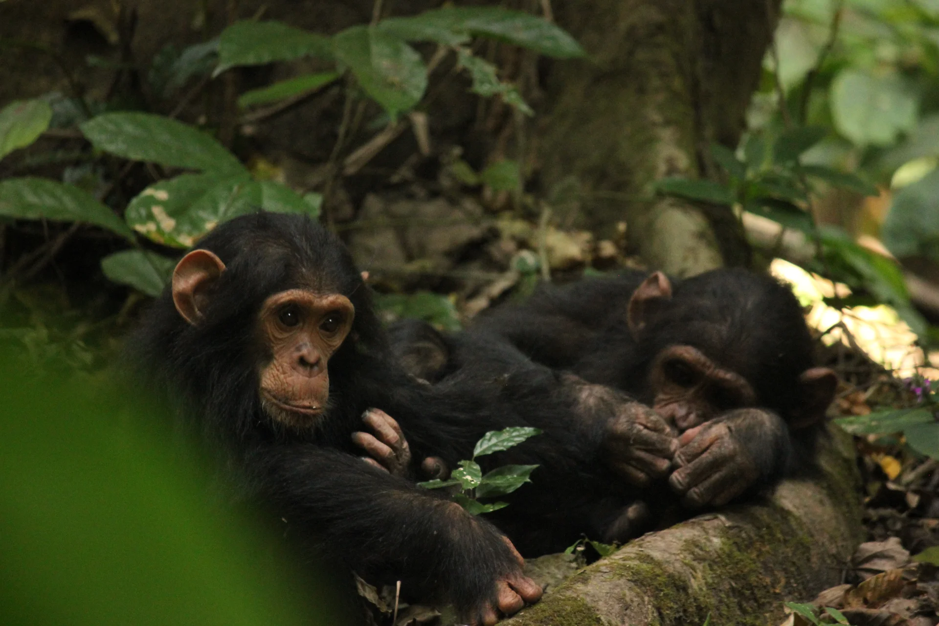
Gombe Stream National Park, also known as Gombe National Park, combines wild chimpanzee trekking with forested hills and the shores of Lake Tanganyika. In Kigoma…
Wildlife
Chimpanzees & Olive baboons
Landscape
National Parks & Safari
Highlights
Wild chimpanzee trekking with park rangers
 Southern Circuit
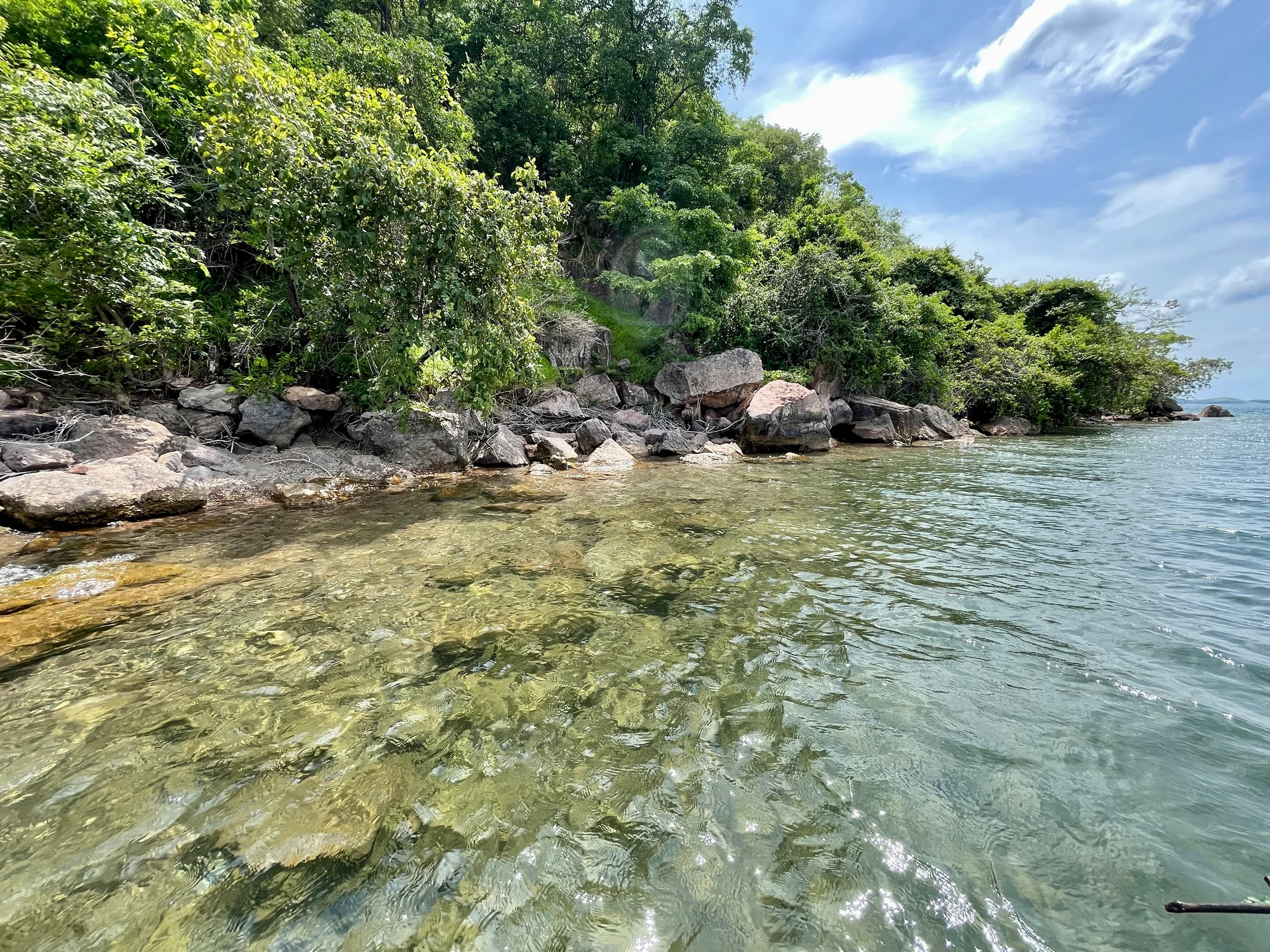
Lake Tanganyika offers a striking freshwater setting along Tanzania’s western frontier: broad blue horizons, wooded shores, bays, beaches and communities whose daily life is closely…
Wildlife
Endemic cichlid fish & Other freshwater fish
Landscape
Lakes & Hot Springs
Highlights
Africa’s deepest freshwater lake in the East African Rift
 Northern Circuit
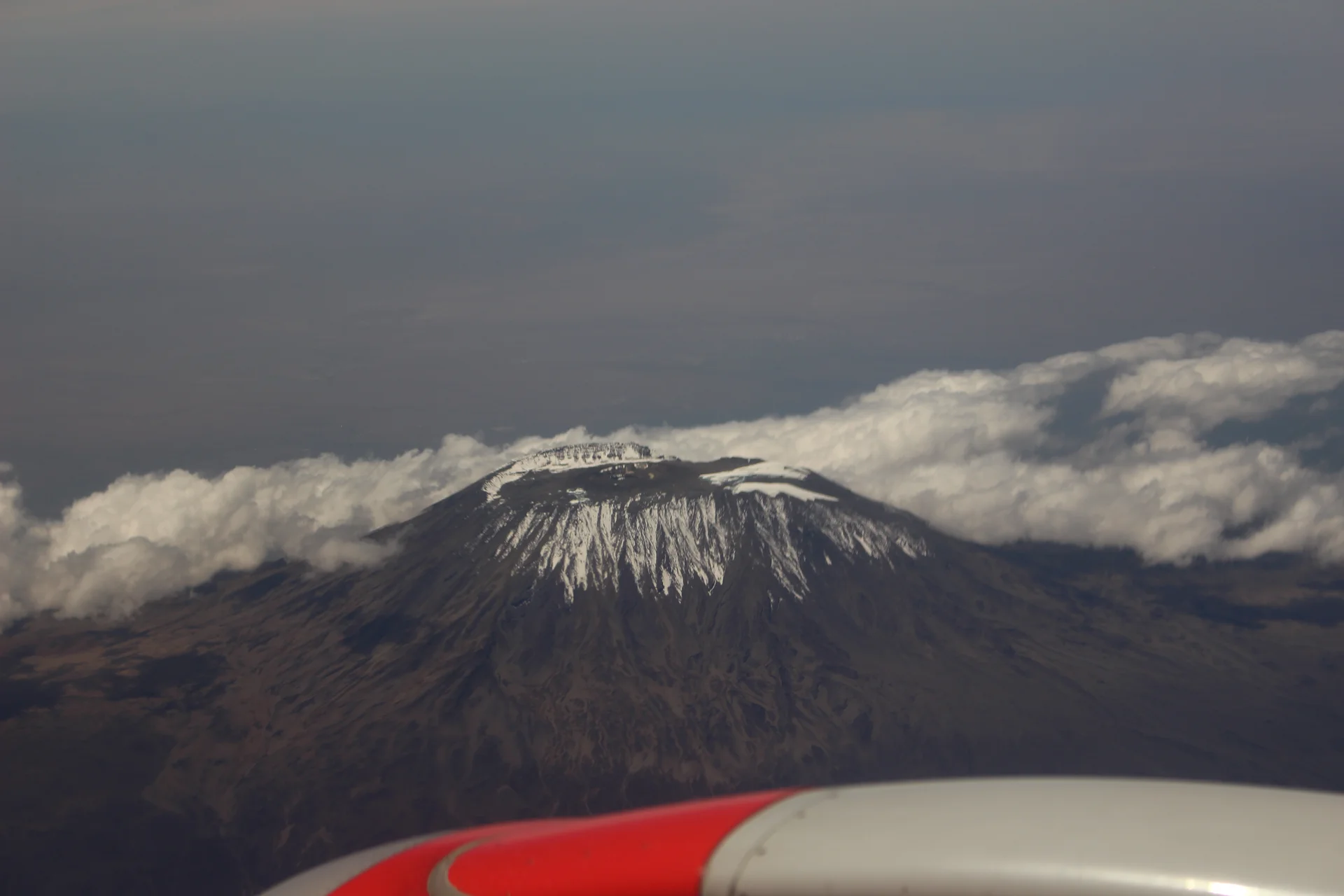
Kilimanjaro rises above northern Tanzania’s plains to Uhuru Peak at 5,895 metres, the highest point in Africa. Its volcanic massif, dramatic changes in vegetation and…
Wildlife
Black-and-white colobus monkeys in forest habitats & Blue monkeys in forest habitats
Landscape
Mountains & Trekking
Highlights
Uhuru Peak at 5,895 metres — Africa’s highest point
 Western Circuit
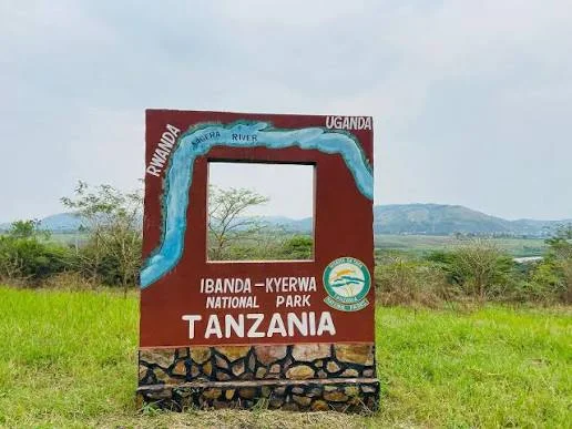
Ibanda-Kyerwa National Park protects a scenic corner of northwestern Tanzania, where the Kagera River meets a landscape of savanna, wooded slopes, valleys and wetlands. Situated…
Wildlife
Buffalo & Roan antelope
Landscape
National Parks & Safari
Highlights
Kagera River scenery on Tanzania’s northwestern border
 Zanzibar & Islands
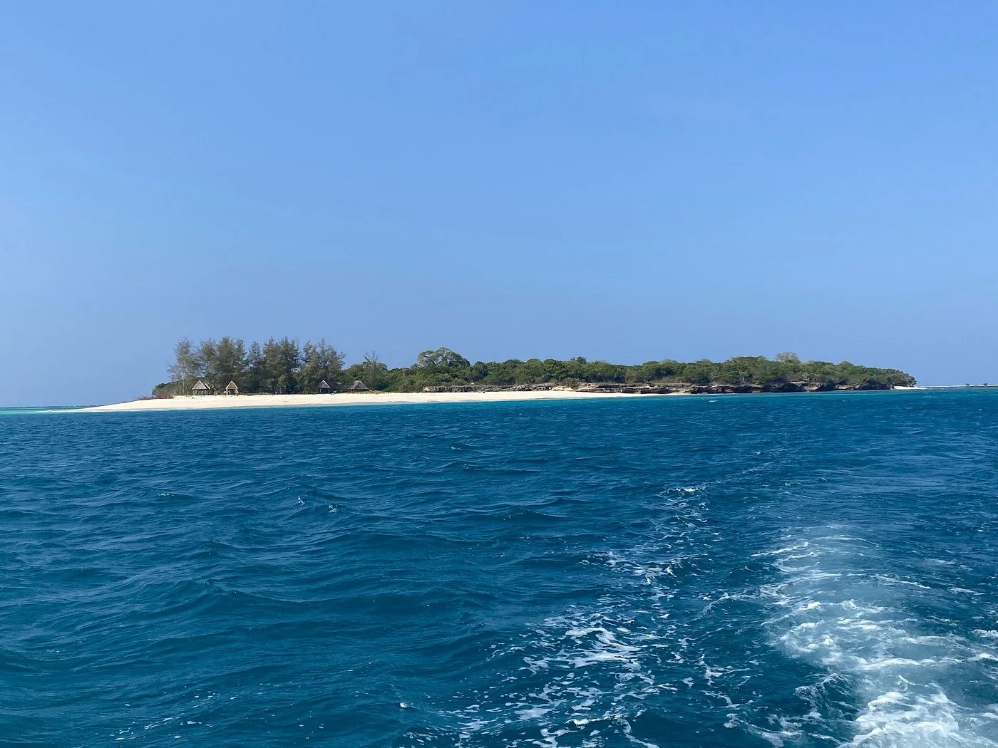
Sinda Island Marine Reserve offers an Indian Ocean escape off Kigamboni, on the southern side of Dar es Salaam. The reserve encompasses Inner and Outer…
Wildlife
Reef fish & Coastal birds
Landscape
Beaches & Islands
Highlights
Inner and Outer Sinda islands
 Northern Circuit
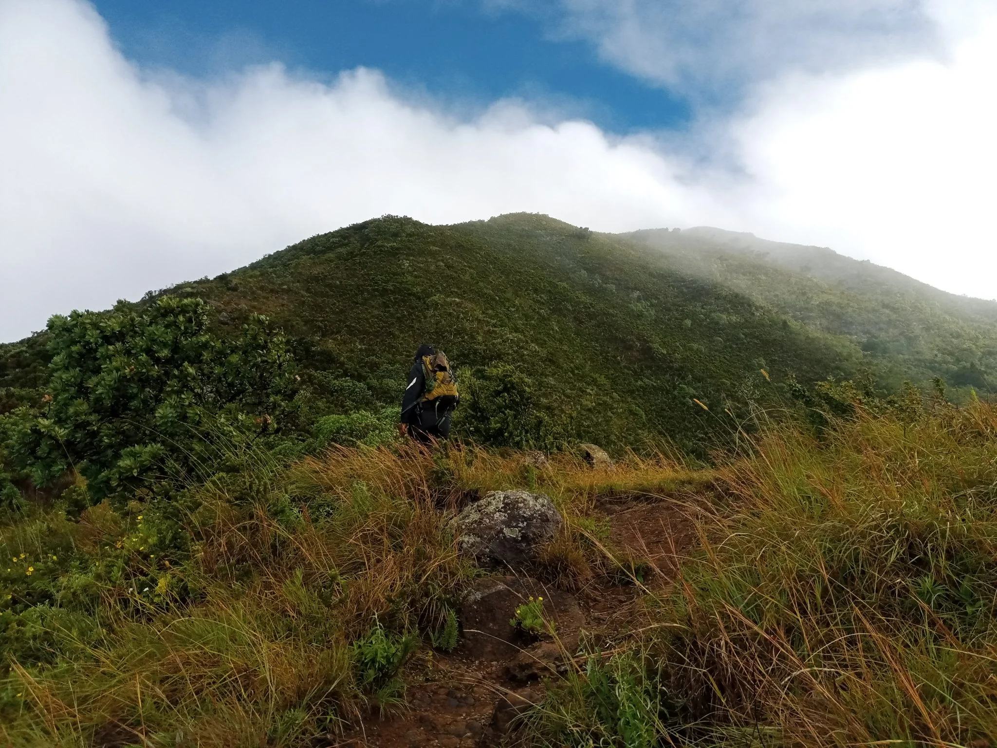
Discover Mount Hanang Rising above Katesh in Tanzania’s Manyara Region, Mount Hanang offers a rewarding mountain adventure beyond the familiar northern safari circuit. At approximately…
Wildlife
Klipspringer & Vervet monkeys
Landscape
Mountains & Trekking
Highlights
Approximately 3,423 metres — Tanzania’s fourth-highest mountain