 5.0 Excellent

.jpg?alt=media&token=e95f28be-1172-4214-9c57-d7397b3a592e)

.jpg?alt=media&token=c2dec673-938a-4a0d-a7a0-4d3dd2830d41)
Dorine M1 year ago

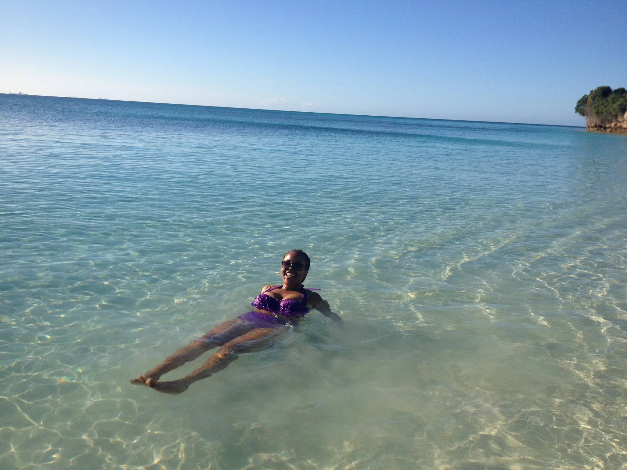
Grateful experience
As a solo female traveler, I felt super safe and well taken care of the entire time.
Read more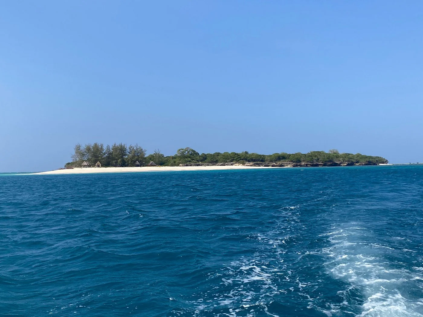
Ocean Islands / Kigamboni, Dar es Salaam Region, Tanzania

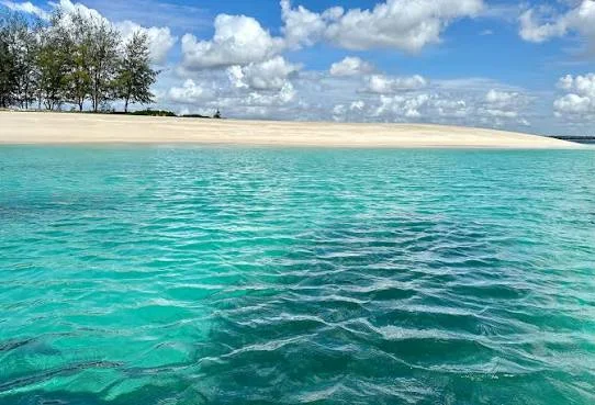
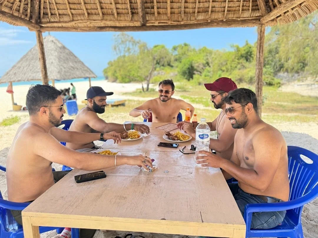
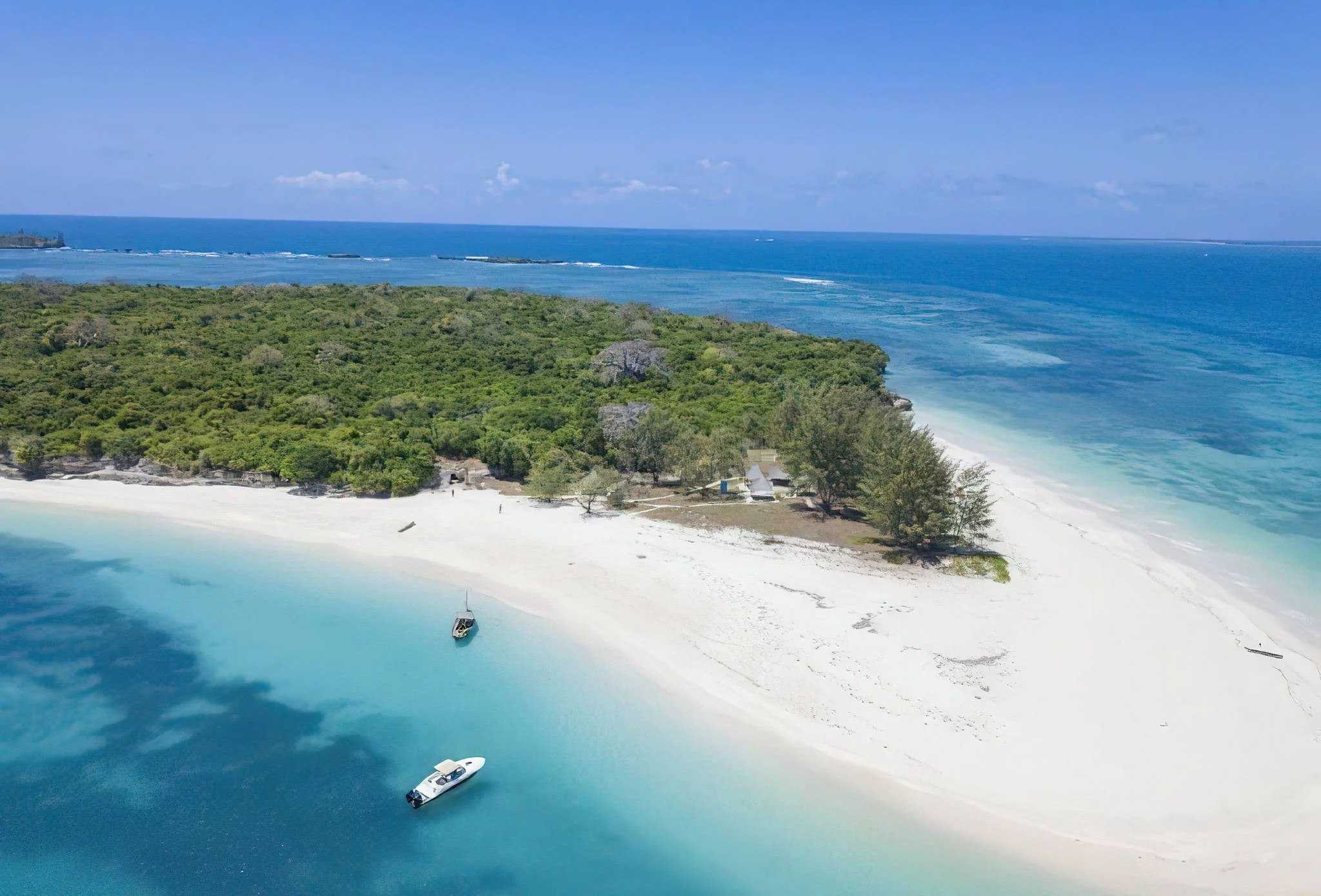
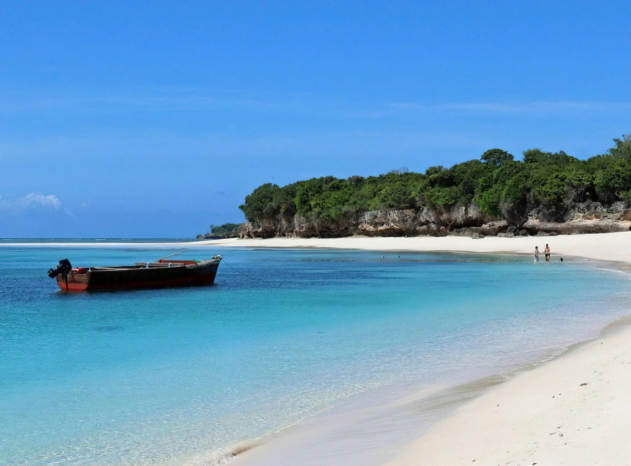
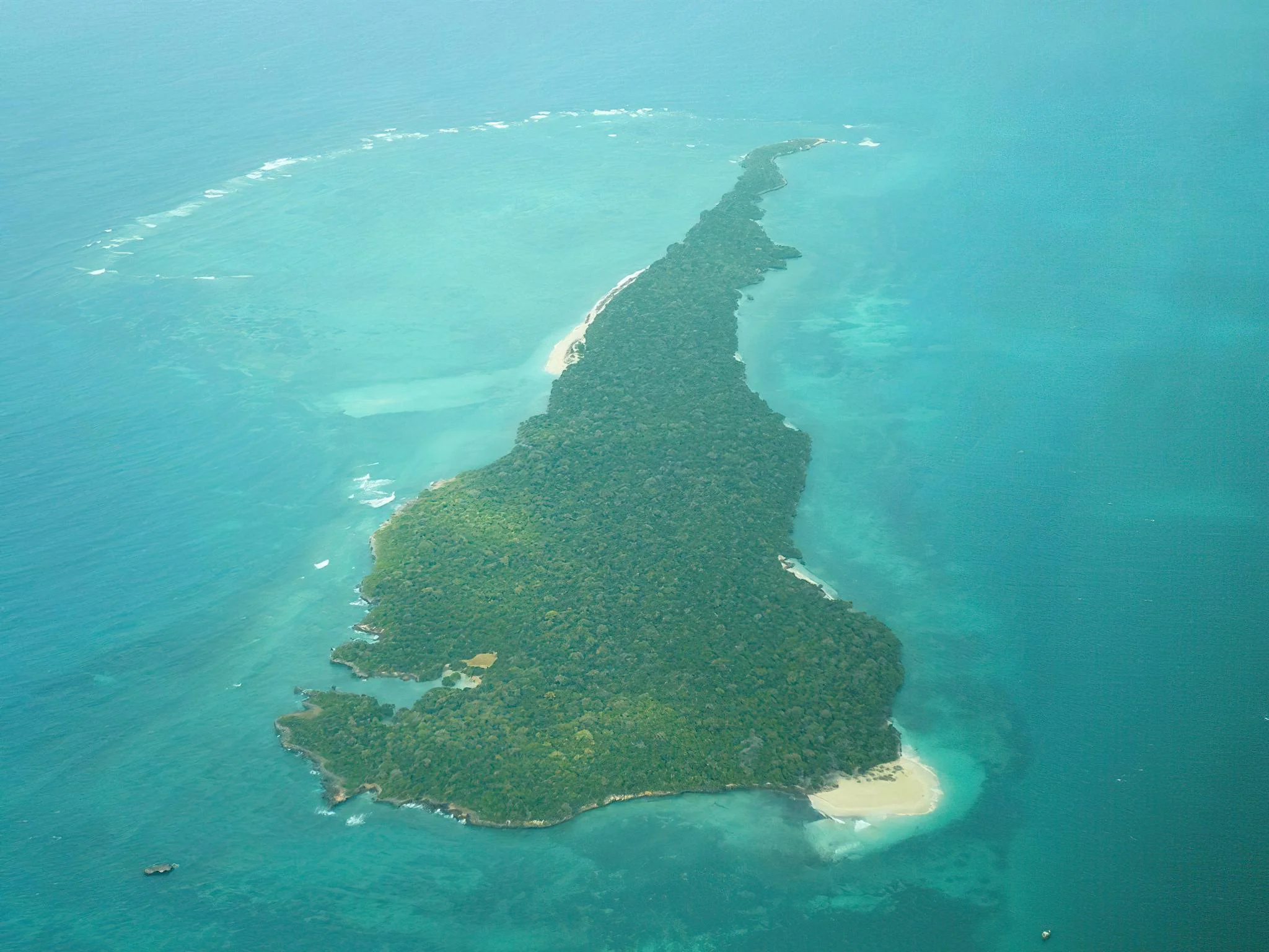
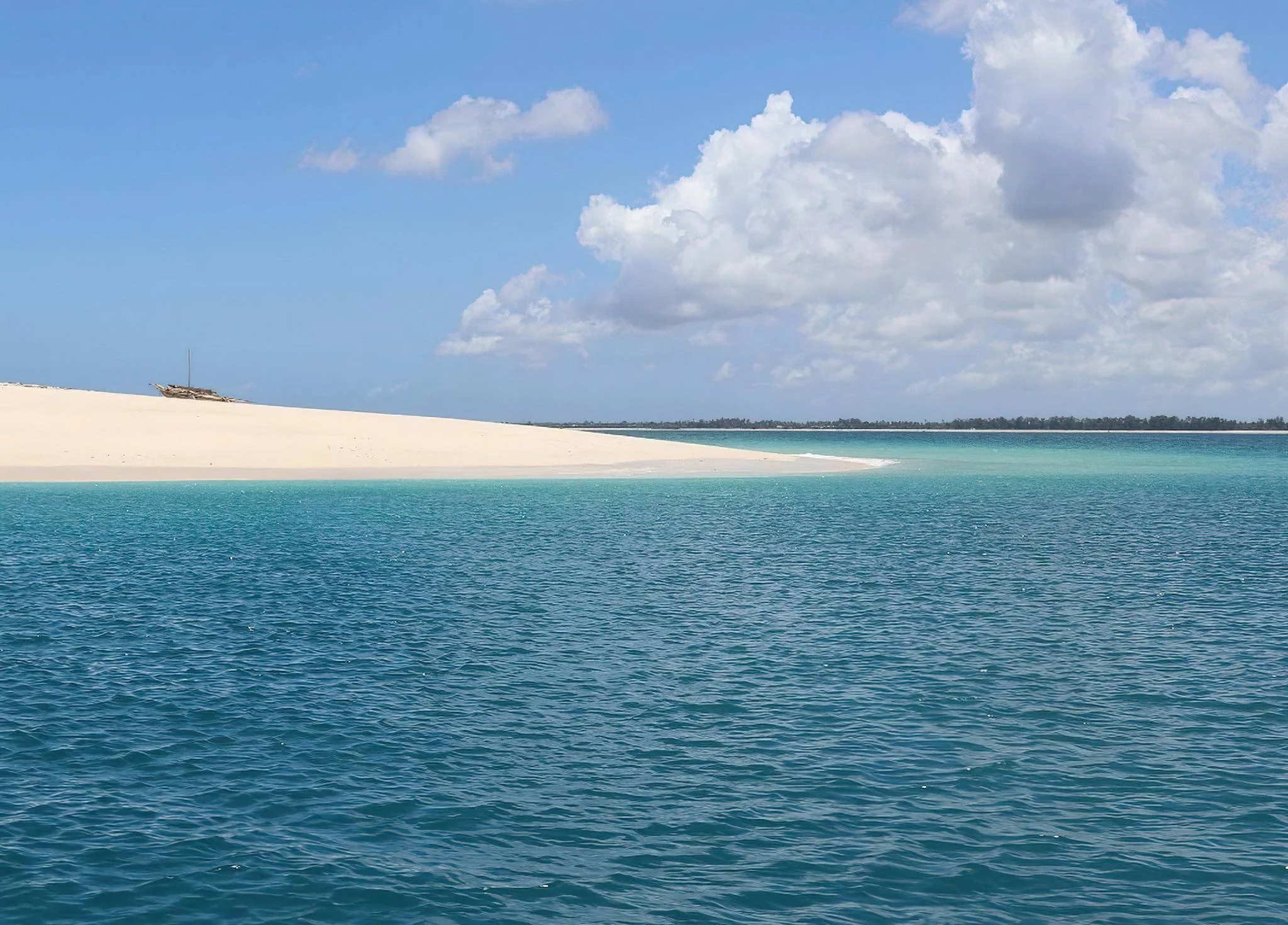
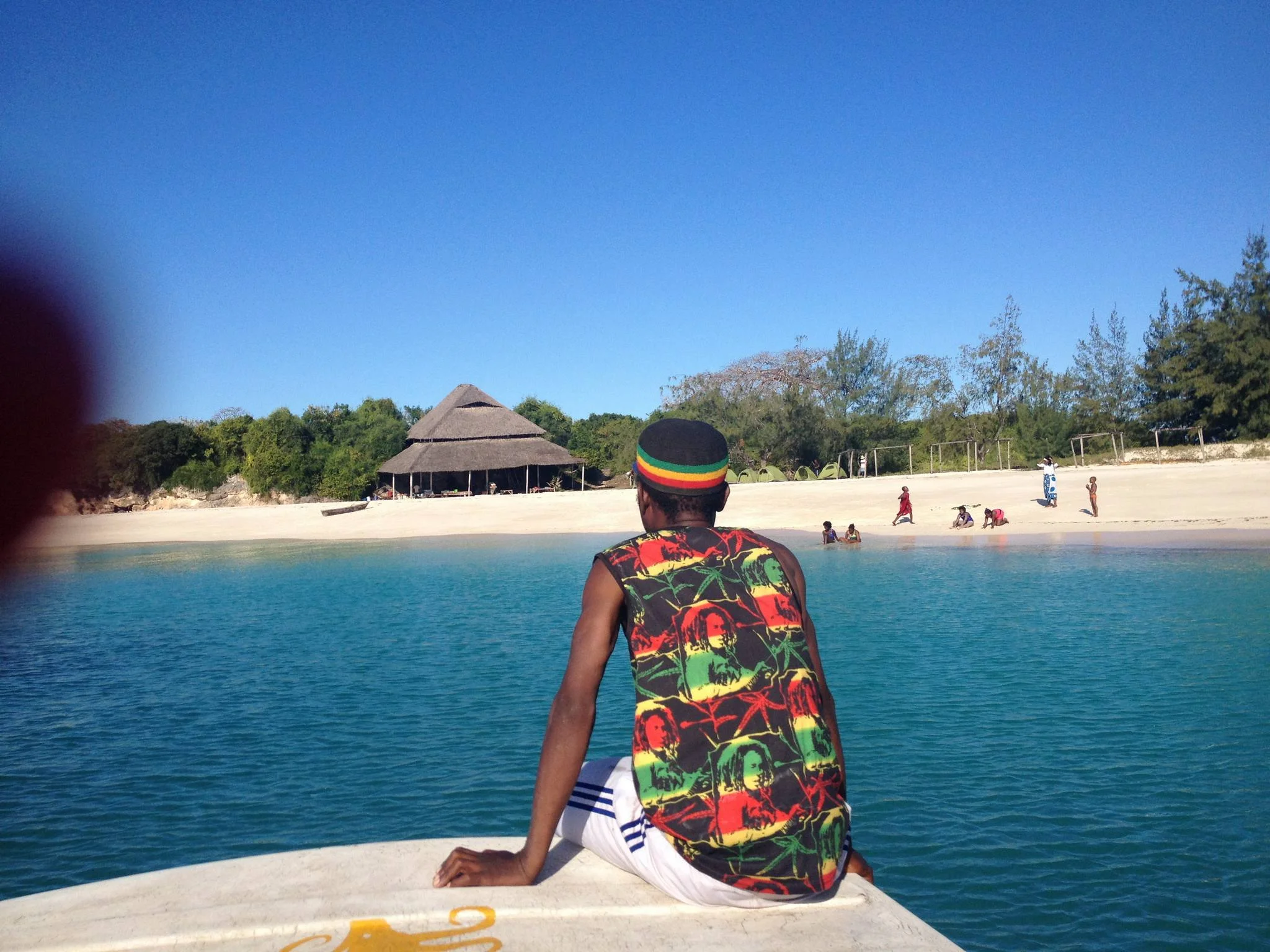
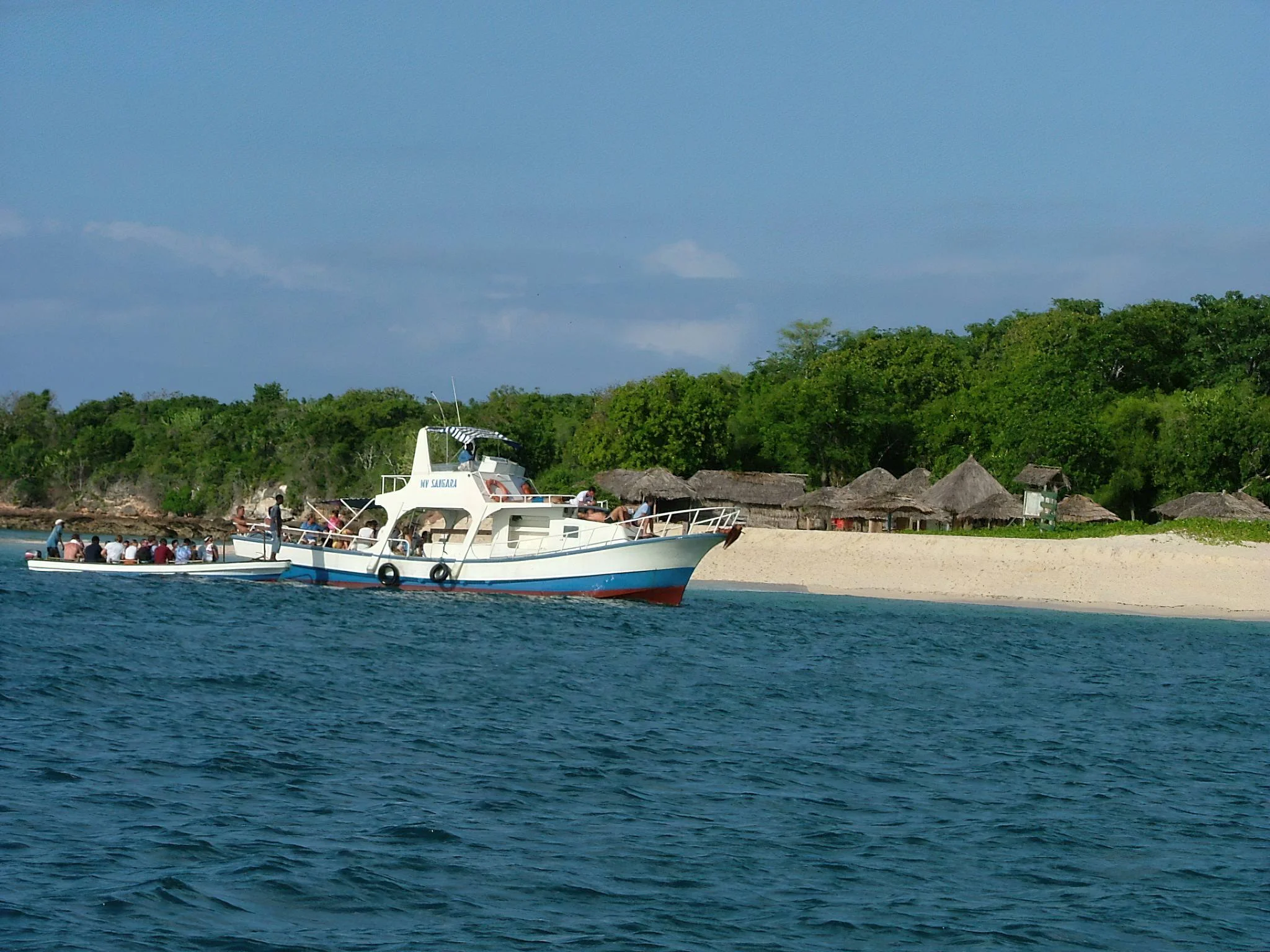
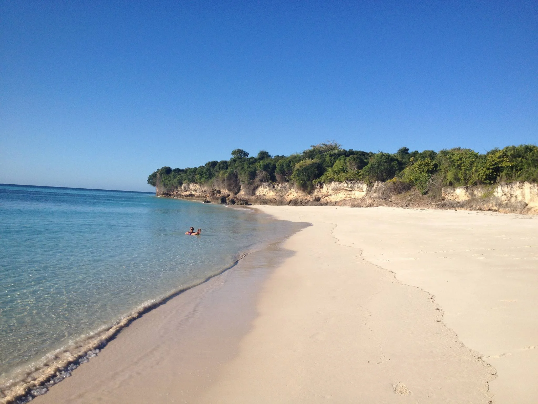
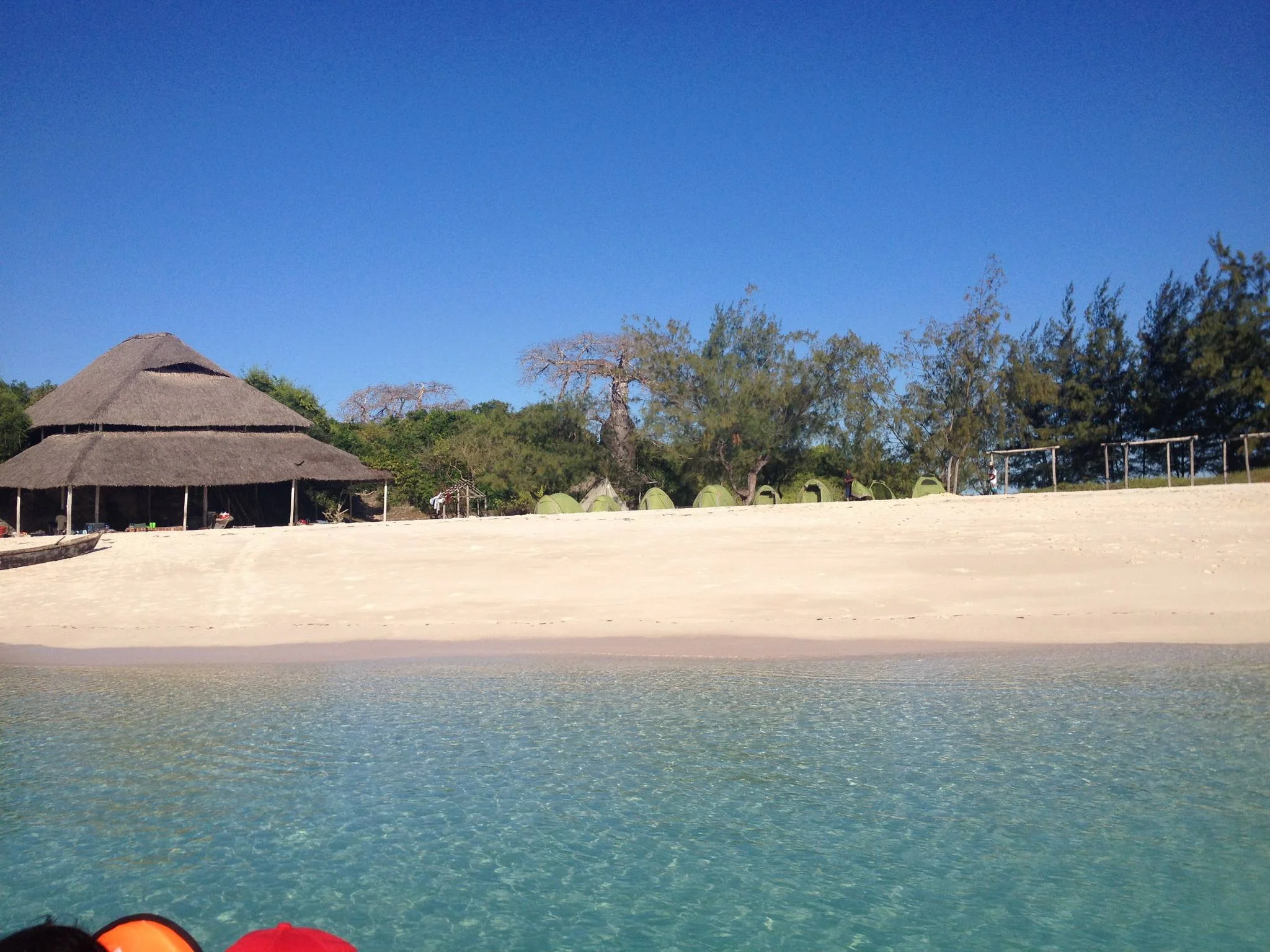
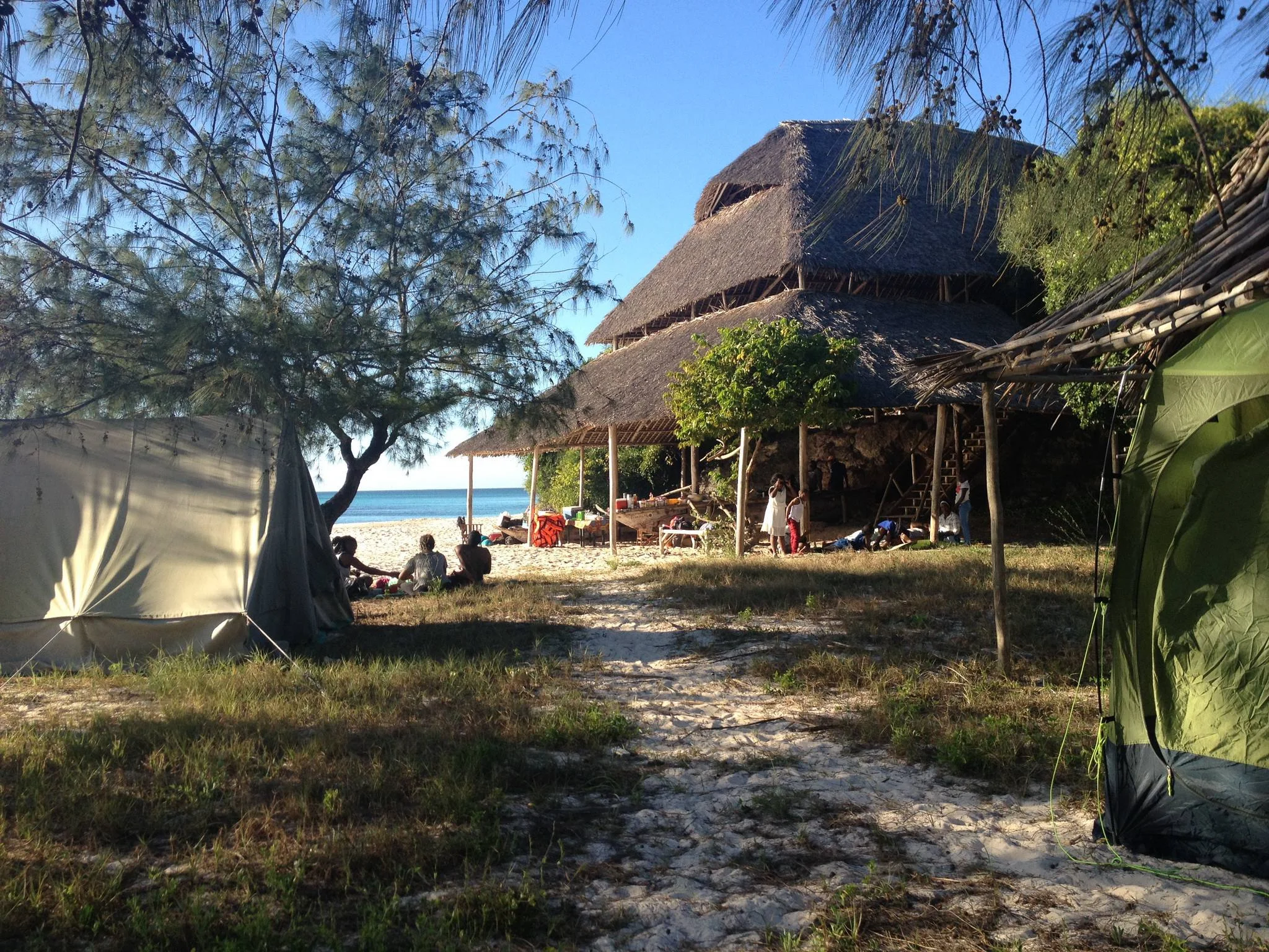
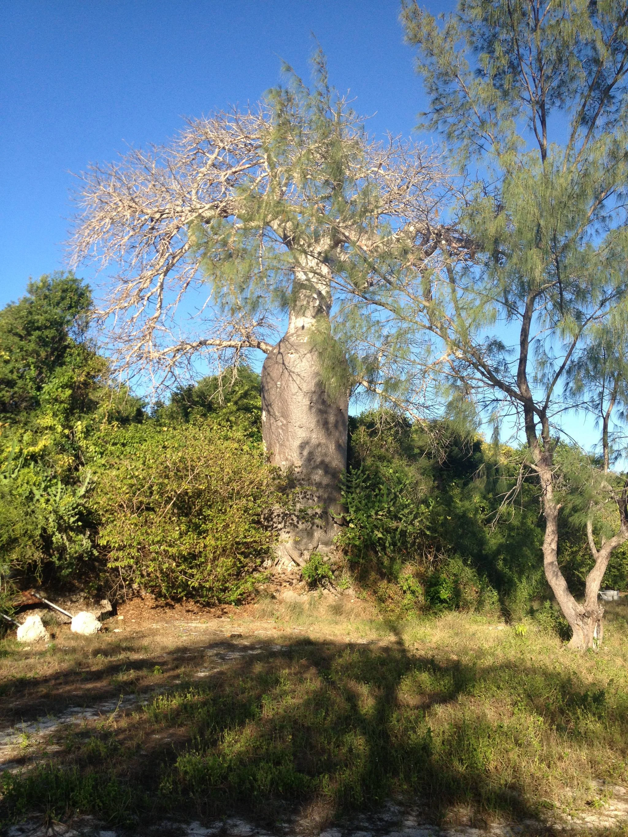
Sinda Island Marine Reserve offers an Indian Ocean escape off Kigamboni, on the southern side of Dar es Salaam. The reserve encompasses Inner and Outer Sinda, combining island vegetation, sandy shores, rocky coastline and surrounding marine habitats. It is part of the Dar es Salaam Marine Reserves system managed by the Marine Parks and Reserves Unit. A visit can suit travellers looking for a carefully arranged day on the water with time for island scenery, photography and relaxation. The two islands and their different shorelines make planning worthwhile. Inner Sinda has sandy beach areas, while exposed rocky sections and intertidal ground create a different experience elsewhere around the reserve. Your guide and skipper should choose the landing and route for the actual tide and sea state. Attractive water and an accessible stretch of sand do not mean that every shore is suitable for swimming, or that every landing is practical throughout the day. Let the local assessment shape the excursion. Marine habitats around the southern Dar es Salaam reserves include coral reefs and seagrass beds that support reef fish and other marine life. A guided snorkelling session may be included when an operator confirms a suitable site, conditions, equipment and supervision. Tell the organiser about swimming ability and experience before booking. Visibility changes, and particular animals should never be promised. Travellers who prefer to stay dry can focus on boat-based views, a permitted shore visit and a picnic arranged as part of the trip. Keep the island programme simple. A guided shoreline walk can reveal changing sand, rock and vegetation, with pauses for photographs and quiet observation. Use the route the guide approves and avoid disturbing birds or entering dense vegetation without guidance. A lunch stop can be a pleasant part of the day if the operator provides food, drinking water, shade and waste removal. Confirm these arrangements beforehand instead of assuming a restaurant, shop, shelter or equipment rental will be available when you arrive. A suggested day begins with a transfer from your Dar es Salaam or Kigamboni accommodation to a confirmed departure beach. Meet the boat team, check life jackets and discuss the route, landing and return plan. After the crossing, enjoy a guided orientation and the activities that conditions permit, allowing time for a prepared lunch and a relaxed shore break. Return at the time agreed with the skipper, with a margin for the onward road transfer. This is a flexible outline rather than a fixed timetable; tide, wind and operating arrangements determine the final sequence. For a two-day coastal break, use the first day for arrival, a mainland beach stay or a relaxed Dar es Salaam visit, and keep the second day for the pre-arranged Sinda excursion. Stay on the mainland unless an overnight island arrangement has been specifically confirmed with the relevant authority and organiser. Avoid scheduling an international flight immediately after a boat outing. A weather change can require a later return, an altered activity or a different day for the excursion. The exposed seaward sides of the islands can experience strong waves and tidal currents, especially around spring tides. Choose an operator with a suitable boat, passenger arrangements, correctly fitting life jackets and a clear weather decision. Follow the skipper’s instructions throughout the crossing and any landing. Swimming, snorkelling and kayaking should be offered only where the guide has assessed conditions and appropriate support is available. Guests can choose a shore-focused programme without taking part in water activities. Treat Sinda as a protected coastal environment. Enjoy wildlife at a distance, avoid standing on or touching coral, leave shells and natural objects in place, and carry all waste back to the mainland. Current reserve entry arrangements and activity permissions should be confirmed before departure. Ask for an itemised quote covering road transfers, boat transport, guiding, admission, equipment, meals and drinking water so the day’s inclusions are clear. Pack sun protection, a hat, a light rain layer, suitable footwear for boarding and shore walking, a towel and a waterproof bag. June to September is generally a drier period around Dar es Salaam, while March to May brings the main rains and October to December often has shorter rains. Sea conditions still require a daily check in every season. Build the visit around the experience you want and the conditions on the day, leaving time to enjoy the island setting at an easy pace.
March–May: The main rainy period around Dar es Salaam can interrupt outdoor plans and boat excursions. Keep dates flexible, confirm whether the organiser is operating and discuss the weather cancellation plan. Shore access, water clarity and the crossing must be assessed for the actual day; do not assume a trip will run because accommodation on the mainland is open.
January–February and October–December: Early-year months commonly provide a relatively drier interval, while October to December often has shorter rains. A tailored island visit may work well when sea conditions permit. Check wind, tide, landing arrangements and snorkelling visibility close to departure; seasonal patterns cannot establish the day’s conditions.
June–September: Generally a drier period for a coastal stay based around Dar es Salaam and Kigamboni. Book a suitable operator and mainland accommodation ahead, while allowing flexibility for changing wind and sea state. Strong currents and exposed shores still require local assessment, including around spring tides.
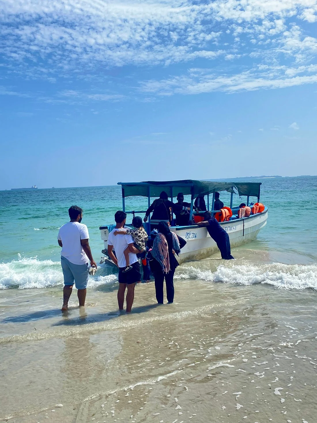
Use Dar es Salaam as the main gateway, with Julius Nyerere International Airport (DAR) serving arrivals. Arrange a road transfer from your hotel to the precise Kigamboni departure point confirmed by the boat organiser. Road time depends on traffic, the starting hotel and the selected route. Allow a buffer before the agreed boat meeting time. Sinda is reached by an organised boat transfer. The Marine Parks and Reserves visitor guide identifies Kipepeo as a departure location for the southern Dar es Salaam islands, but confirm the currently operating departure beach, meeting instructions and Sinda route directly with your organiser. Do not arrive expecting an unscheduled public ferry or a guaranteed daily departure. Crossing time varies by route, boat and sea conditions; ask for a current estimate and return plan. Before departure, confirm reserve admission or entry permits, approved activities, suitable life jackets, skipper, passenger arrangements and the weather decision. Agree whether landing, guided snorkelling, equipment, shade, meals, drinking water and mainland transfers are included. Landing and the programme depend on tide, swell and current conditions. Arrange the return with the same care as the outward trip and avoid a tight flight connection immediately afterwards.
Sinda lies off Kigamboni on the southern side of Dar es Salaam’s coast, in the Indian Ocean. It is part of the Dar es Salaam Marine Reserves system. Plan the mainland transfer and boat departure around the exact location confirmed by your organiser.
The reserve includes two islands with differing shorelines and exposure to the sea. Inner Sinda has sandy beach areas, while other sections include rocky and intertidal ground. Ask which island, landing and activities your trip will use, since conditions influence the route.
The appeal is a combination of island scenery, beach time and surrounding marine habitats close to a Dar es Salaam stay. A well-planned excursion can include photography, a guided shore visit and optional water activities suited to your experience and the day’s conditions.
Arrange a mainland transfer to a confirmed departure beach in Kigamboni, followed by an organised boat crossing. The official visitor guide identifies Kipepeo for southern island access. Confirm current operations and your precise meeting point, as a published departure location does not guarantee a daily service.
The crossing depends on the departure point, boat, route and sea state. Request a realistic current estimate from your operator and include time for boarding and landing. Build the day around the agreed return plan rather than relying on a fixed crossing time from an old itinerary.
A day excursion can be considered after confirming access and boat operations. Allow time for the mainland transfer, safety briefing, crossing, suitable shore or water activities and the return. Keep the sequence flexible and agree what happens if weather prevents the planned landing.
Spend the first day settling into mainland accommodation in Dar es Salaam or Kigamboni, with a relaxed local visit. Reserve the second day for a pre-arranged Sinda excursion if conditions allow. This outline includes a mainland overnight stay; any island overnight arrangement must be separately confirmed.
June to September is generally drier around Dar es Salaam, while March to May is the main rainy period and shorter rains often occur in October to December. Daily wind, waves and tides still determine boating and water activities in every season.
Swim only where the guide or operator has assessed the location and conditions as suitable for your ability. Exposed shores and tidal currents can be challenging. Follow local advice and stay out of the water if the operator cannot provide an appropriate supervised option.
Guided snorkelling may be arranged when a suitable site, sea conditions, visibility, equipment and supervision are confirmed. Tell the operator your experience and swimming ability beforehand. Coral habitat does not guarantee clear water, easy entry or particular wildlife on the day of your visit.
Discuss individual abilities before booking. A shore-focused programme with boat views, photography and a suitable picnic stop may be possible without snorkelling. The crossing and boarding still need to suit every participant, and no guest should feel obliged to enter the water.
Look for reef fish during an appropriate guided water activity and coastal birds during quiet observation. Marine life and sightings vary. Keep your distance, leave natural objects in place and avoid touching coral or disturbing animals for a photograph.
Kayaking may be considered only when the organiser confirms permission, suitable equipment, supervision and conditions. Do not assume equipment is available on arrival or that an advertised activity operates daily. Agree the exact programme before paying and accept changes when conditions require them.
Ask the organiser exactly what will be provided and where. Confirm drinking water, meals, shade, toilets or changing arrangements before departure. Plan for a self-contained outing unless specific services are confirmed, and bring dietary requirements to the organiser’s attention in advance.
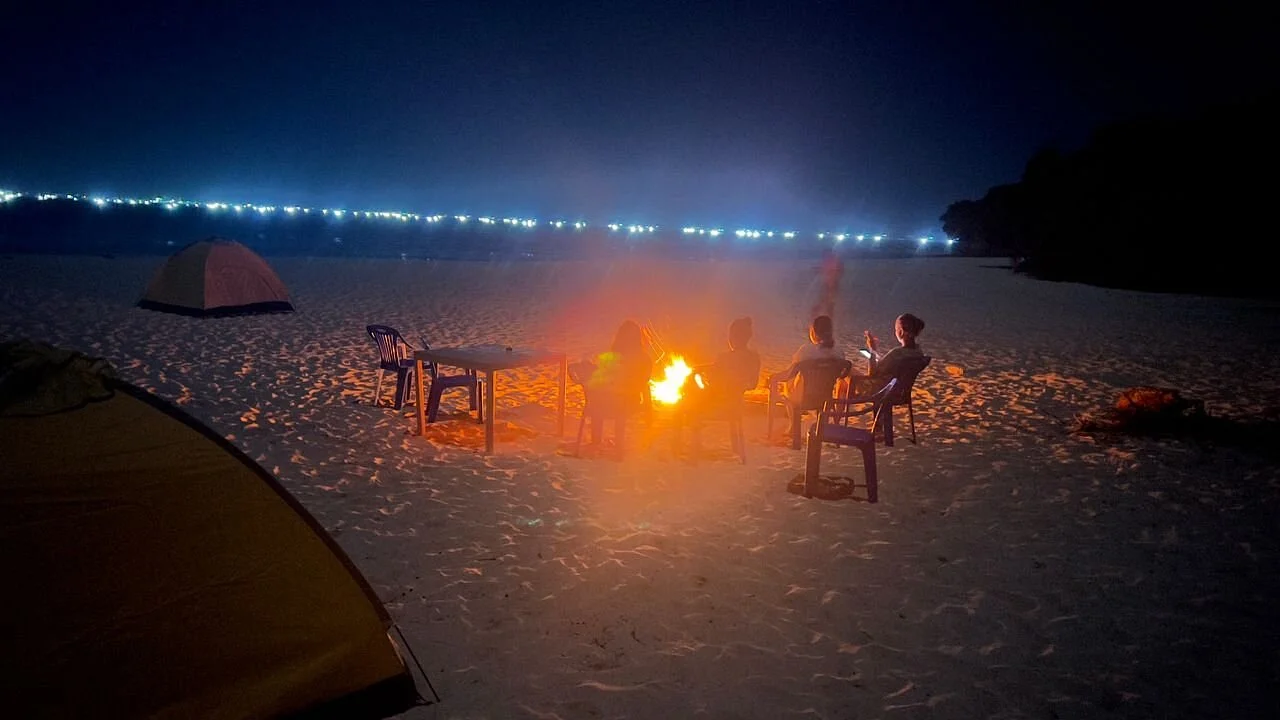
Treat Sinda as a planned day excursion unless the authority and operator specifically confirm an authorised overnight arrangement. Ask about permission, accommodation, sanitation, supplies and return transport. Do not assume an island hotel, campsite or emergency boat service is available.
Suitability depends on age, comfort on boats, supervision and the planned activities. Confirm correctly fitting life jackets for every child, boarding arrangements and shade before booking. Keep the day relaxed, with breaks, and choose activities based on the family’s abilities and conditions.
Boat boarding, beach landing, sand and uneven shore surfaces may present difficulties. Share your specific needs with the organiser so they can check the actual boat and landing arrangement. Consider an adapted programme only once practical assistance and return arrangements are clearly confirmed.
Bring sun protection, a hat, water, a light rain layer, a towel, a waterproof bag and footwear suitable for boarding and shore walking. Confirm any supplied snorkelling gear and meals. Carry all personal waste back and keep equipment secured during the crossing.
Plan a non-extractive visit to the marine reserve. Leave shells, coral and other natural objects where they are, and do not fish as part of the excursion. Confirm current reserve rules with the organiser and follow the authority’s instructions for every activity.
Request a breakdown covering road transfers, boat transport, reserve entry, guiding, equipment, meals and drinking water. Confirm the approved activities, return time, weather cancellation policy and any extra charges. A boat quotation alone should not be assumed to include every part of the day.
Grateful experience
As a solo female traveler, I felt super safe and well taken care of the entire time.
Read morePrivate Safari 6 days
I can only highly recommend the young company Tanzalux for organizing a private safari.
Read moreAn unforgettable vegetarian journey with Tanzalux Safaris
I highly recommend Tanzalux for anyone wanting a special, personalized safari.
Read moreOur 3-day camping safari with Tanzalux was simply fantastic! Everything was perfectly organized.
Read moreBack in April, I joined a day trip to Tarangire National Park with Tanzalux Safaris, and it was truly one of the best experiences I have ever had…
Read moreI've had an amazing experience with Tanzalux Safaris, would 1000% recommend! Thank you for making my trip so special🫶
Read moreI recently visited Meru Waterfalls in Arusha and got to do some of the activities there, honestly it was such a great experience and I really enjoyed it.
Read moreOur guide Dullah Mr Rastaman had the best vibe. I would like to recommend other people not to miss it, Tarangire is the best national park.
Read moreOur tour guide Nasri was very friendly and welcoming from the first day we met him. He knows Tarangire very well and explained many things during the safari.
Read moreAs a grandmother in the group, I would like to share my happiness with Tanzalux Safaris. Me, my daughters, and my grandson went on a short trip to Tarangire National Park…
Read moreReceive a free, no obligation quote

 Western Circuit / Kigoma Region,Tanzania
Gombe Stream National Park, also known as Gombe National Park, combines wild chimpanzee trekking with forested hills and the shores of Lake Tanganyika. In Kigoma Region in western Tanzania, north of Kigoma town, the park offers a distinctive safari experience shaped by walking, lake travel and close observation of forest life. Gombe is internationally associated with the chimpanzee research begun by Jane Goodall in 1960. Ranger-led forest treks give visitors an opportunity to observe chimpanzees in their natural habitat while respecting their movements and the park’s conservation rules. Sightings are not guaranteed: locating the animals can involve variable search times, steep slopes and humid conditions. Discuss fitness, mobility and current age requirements before booking. The forest supports other primates, including olive baboons, colobus and several monkey species, along with diverse birdlife and butterflies. Guided walks can also explore scenery such as Kakombe Waterfall and Jane’s Peak when routes and conditions are suitable. The pebbled lakeshore and boat approach provide a different perspective on the park, with time to enjoy Lake Tanganyika between planned activities. Any swimming or snorkelling should follow current ranger guidance and use permitted places. Chimpanzee viewing is carefully managed. Follow your ranger, keep the required distance, wear the required mask during encounters, avoid flash photography and never feed or touch wildlife. Do not join a trek with an infectious illness. Confirm the current TANAPA viewing, health, age and group requirements with your operator before travel. Access is by arranged boat from Kigoma, so coordinate flights, accommodation, park entry, guiding and transfers in advance. A stay of two nights gives more room for trekking and scenery than a rushed visit. Keep the itinerary flexible around chimpanzee movements, trail conditions and the lake crossing. Bring sturdy footwear, light layers, rain protection, water, sun protection and a waterproof bag for boat transfers.
Wildlife
Chimpanzees & Olive baboons
Landscape
National Park / Chimpanzee Trekking / Lakeshore Forest
Highlights
Wild chimpanzee trekking with park rangers
 Western Circuit / Kigoma, Katavi & Rukwa Regions/Tanzania
Lake Tanganyika offers a striking freshwater setting along Tanzania’s western frontier: broad blue horizons, wooded shores, bays, beaches and communities whose daily life is closely connected with the water. Shared by Tanzania, Burundi, the Democratic Republic of the Congo and Zambia, it occupies a long basin in the western arm of the East African Rift. With a maximum depth of about 1,470 metres, it is Africa’s deepest lake and the second deepest in the world. Its scale gives a lakeshore holiday a sense of space, while each part of the coast offers a different experience. On Tanzania’s side, Kigoma is an important gateway for lake journeys and a useful base for combining time on the shore with town and heritage visits around Ujiji. The waterfront and harbour reveal the lake’s role in transport and trade, and local guides can help visitors understand places through the people who live and work there. Farther along the shore, a quieter lodge or camp can provide a slower rhythm of scenic boat trips, beach time and watching the changing light across the water. The lake is especially interesting for its freshwater fish, including colourful cichlids and many species found only in this ecosystem. At suitable sites, guided snorkelling or diving can reveal a different side of a safari holiday. Kayaking and canoeing may also be offered by individual properties or operators. Confirm the site, equipment, supervision and conditions for each activity. Water clarity, wind and waves vary, and swimming should follow current local advice at designated places. Relaxing beside the lake, with a book or a camera, is equally rewarding when conditions do not suit a water outing. Gombe Stream and Mahale Mountains national parks add forest experiences to selected lake itineraries. Ranger-guided chimpanzee trekking, forest walks, birds and viewpoints can be combined with time on their lakeshores, with separate park bookings and activity arrangements. These are visits to protected areas with their own access routes and rules. Allow enough time for transfers and the guided programme so that a lake stay and a forest visit both receive the attention they deserve. Travellers considering the southern Tanzanian shore can look at the Kipili area, with road or charter arrangements planned around the chosen property. The distances between lake destinations are substantial, and moving along the coast requires practical coordination. Choose one lakeshore base for a short stay, then add another area only when the transport plan and available time support it. A suggested starting point is three or four nights at one base, with extra nights for Gombe, Mahale or a wider western Tanzania safari. June to October generally offers the main dry-season window for many western Tanzania lake and forest itineraries. Wetter months can bring lush scenery and atmospheric skies, while road conditions, boat transfers and lodge operations need closer checking. Even in dry weather, wind can affect the lake. Use an operator who knows the route, arrange transfers and accommodation in advance, and leave flexibility around onward connections. A visit can suit couples looking for a restful lakeside stay, families with a manageable programme, photographers, fish enthusiasts and travellers combining wildlife with culture. Discuss comfort, accessibility, meals, charging and activity needs before booking, especially at remote properties. Support local guides and businesses, ask before photographing people, and leave the shores and water free of litter.
Wildlife
Endemic cichlid fish & Other freshwater fish
Landscape
Freshwater Lake / Lakeside Holiday / Water Activities / Culture
Highlights
Africa’s deepest freshwater lake in the East African Rift
 Western Circuit / Kagera Region/Tanzania
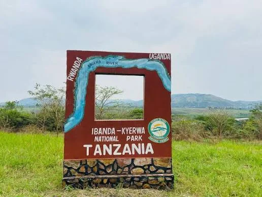
Ibanda-Kyerwa National Park protects a scenic corner of northwestern Tanzania, where the Kagera River meets a landscape of savanna, wooded slopes, valleys and wetlands. Situated in Kyerwa District in Kagera Region, the park lies beside Rwanda and Uganda and became a national park in 2019 after its earlier protection as a game reserve. Its setting makes it an interesting choice for travellers building a western Tanzania itinerary or exploring the wider Great Lakes region. The river is central to the experience. Along parts of the boundary it separates Tanzania from Rwanda and Uganda, with Rwanda’s Akagera National Park across a section of the river. Inland, rolling hills give way to plains and a basin crossed by seasonal streams, scattered lakes and swamps. Acacia savanna and riverbank vegetation create contrasting views during a drive. Allowing time for the scenery, birds and smaller details brings more to a visit than moving quickly from one wildlife stop to another. Buffalo and antelope are important wildlife attractions. Roan antelope, topi, eland, impala, waterbuck, reedbuck and bushbuck are among the species described in TANAPA’s guide. Leopards and hyenas are recorded predators, while hippos and crocodiles inhabit the river and wetland environments. Each outing depends on animal movement, vegetation, weather and the guide’s knowledge. A patient itinerary, with repeated drives through suitable habitats, gives time to appreciate the park without depending on a particular sighting. Game drives form the core of a safari here. Guided walks can add a closer look at tracks, plants and the landscape when arranged with park authorities. Birdwatching is another strong reason to slow down: TANAPA’s guide reports more than 200 recorded species, with examples including African fish eagle, augur buzzard, Egyptian goose and cinnamon-chested bee-eater. Bring binoculars and leave room for quiet observation. Designated picnic stops and river viewpoints can provide a pleasant break, while photography changes with the light and the season. For planning, June to early October generally offers the main dry-season window. January and February can also provide a drier interval, though actual rainfall varies. Rainfall is associated with the later part of the year and March to May; recent showers can affect road conditions and the routes available. Choose dates around the experiences that matter most, and ask the operator to reconfirm access and any guided activities before departure. We suggest two nights as a useful starting point, with additional time for birding, walks or a combination with Rumanyika-Karagwe National Park. Camping can be arranged through the park, and Murongo is the nearest practical town for simple accommodation. Confirm the exact campsite or property, meals, equipment and facilities when booking. Travellers who prefer more comfort should agree on their accommodation standard before the route is finalised. Bukoba and Chato are potential air gateways followed by a road transfer, while charter access requires specific advance arrangements. Murongo is a useful reference point for the final approach. Distances alone do not provide a reliable travel time, so plan transfers around the chosen route, road conditions and current park hours. Ibanda-Kyerwa rewards travellers who bring curiosity, binoculars and enough time to explore at an unhurried pace.
Wildlife
Buffalo & Roan antelope
Landscape
National Park / Wildlife Safari / River Scenery / Birdwatching
Highlights
Kagera River scenery on Tanzania’s northwestern border
 Northern Circuit / Hanang District, Manyara Region / Tanzania
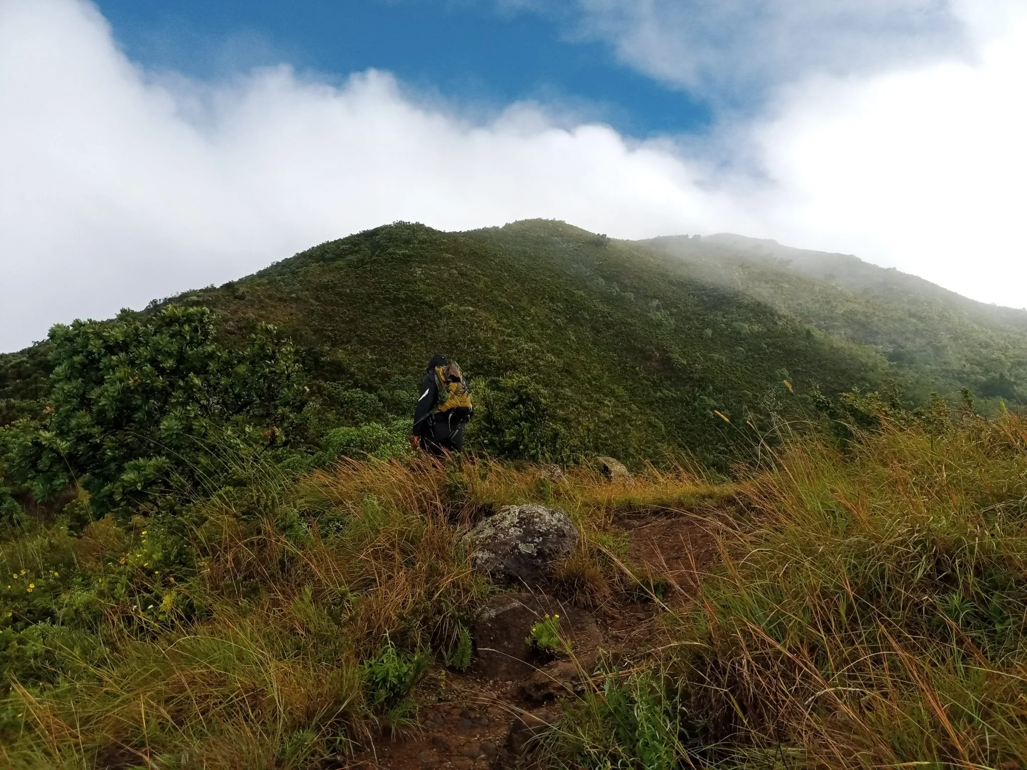
Discover Mount Hanang Rising above Katesh in Tanzania’s Manyara Region, Mount Hanang offers a rewarding mountain adventure beyond the familiar northern safari circuit. At approximately 3,423 metres, it is Tanzania’s fourth-highest mountain: a substantial climb with changing vegetation, open upper slopes and expansive views when the weather clears. Its appeal lies in the journey through a varied mountain landscape as much as in reaching the summit. Travellers who enjoy walking, natural history, photography and a quieter setting can make Hanang a distinctive part of a Tanzania itinerary. The mountain is protected within Mount Hanang Nature Forest Reserve, managed by the Tanzania Forest Services Agency. It lies in Hanang District and is approached through the Katesh area. This is a forest reserve destination, with its own access arrangements. Plan the excursion with the reserve administration and a knowledgeable local guide before travelling, so that the chosen route, permissions, transport and available support match the trip you intend to take. A mountain of changing habitats One of Hanang’s most interesting qualities is its ecological variety. The reserve includes dense forest, open forest, woodland, bushland, grassland and heathland. These environments change the character of a walk as you gain height: shaded vegetation gives way to more exposed landscapes, and the pace naturally slows as the air becomes thinner. Forest and hillside vegetation also contribute to the importance of this protected mountain as a natural catchment and a place for conservation. Visitors should expect a mountain landscape rather than a conventional vehicle-based wildlife safari. Time spent observing vegetation, listening for birds and examining the transition between habitats adds depth to the climb. TFS records mammals including klipspringer, vervet monkeys, bushbabies, rock hyrax, bush pigs and olive baboons, as well as elusive leopard and spotted hyena. The Hanang mole-rat, Fukomys hanangensis, is a distinctive part of the mountain’s biodiversity; its underground habits make it a conservation interest rather than a promised sighting. Documented birds include Hartlaub’s turaco, speckled mousebird, little swift and cinnamon bracken warbler. Animal sightings depend on habitat, season and chance. A guide can interpret what is actually present along the permitted route and help keep wildlife observation respectful. Trekking and the summit experience A summit attempt requires stamina, steady pacing and realistic expectations. Although Hanang is lower than Kilimanjaro and Mount Meru, the climb still involves sustained ascent, uneven ground and a long descent. Weather, trail conditions, starting point and the group’s pace determine the time needed. Avoid booking around an inflexible summit timetable or treating a distance quoted for one route as valid for every approach. Tanzania Tourism identifies three approaches: Katesh from the southwest, Gendabi from the northwest and Giting from the east. Katesh is the commonly used approach. The appropriate route depends on current conditions, permission, local logistics and the group’s experience; confirm the actual starting point with your guide. Select an itinerary that fits the least experienced walker in the group. A guided lower-slope walk can be worthwhile for visitors who prefer scenery and forest interpretation without a summit objective. For a longer mountain outing, discuss whether an overnight plan is appropriate: camping is among the reserve’s listed activities, but locations, permission, water arrangements, equipment and support must be confirmed in advance. Do not assume that huts, meals, porters or serviced campsites are automatically included. Start with a clear plan for the descent and a conservative turnaround time. The summit is an optional achievement; returning safely is essential. Cloud can hide distant views, and wind, rain or slippery terrain may change the day’s objective. The guide should be able to adjust the walk when conditions or the group’s energy make continuing unwise. Altitude and preparation At this elevation, altitude can affect visitors even when they are physically fit. Allow time to adjust, walk steadily and discuss individual health concerns with a qualified clinician before the trip. Headache, nausea, dizziness or unusual fatigue after ascent should be reported promptly, with no further ascent while symptoms are assessed. Worsening symptoms require descent; confusion, poor coordination or breathlessness at rest require urgent assistance. A successful Hanang hike does not guarantee protection from altitude illness on another mountain. Prepare with regular walking and uphill exercise, and arrive rested. Wear broken-in hiking footwear with dependable grip. Carry a rain layer, warm insulating clothing, sun protection, enough drinking water and food for the agreed itinerary. Trekking poles can help on the descent, and a headlamp is useful even when the intention is to finish in daylight. Overnight trips require a separate equipment plan suited to cold, damp or windy conditions. Choose timing around mountain conditions Northern Tanzania’s generally drier period from June to October often offers a useful planning window for walking, but it does not guarantee clear skies or dry trails on Hanang. March to May usually brings the long rains, while shorter rains commonly affect part of October to December. January and February may offer drier intervals, with local conditions varying from year to year. Rain can make paths muddy and descents more demanding. Exposed upper slopes may feel cold even after a warm start near the mountain’s base. Check the local forecast and ask the guide or reserve team about the condition of the actual route shortly before departure. Allow flexibility in the itinerary rather than relying on a seasonal label alone. Katesh, access and local encounters Katesh is the practical starting area for organising a Hanang visit. Many travellers approach overland from Arusha or connect the mountain with a wider journey through Manyara. Road travel and the final approach to a trailhead depend on the selected route, road conditions and stops; obtain a current transfer estimate instead of assuming a fixed driving time. Travellers arriving through Kilimanjaro International Airport or Arusha Airport still need an onward road transfer. Use local knowledge to plan accommodation, meals, early departure logistics and return transport. Community visits can add a meaningful dimension to a mountain journey when arranged with willing hosts. Ask permission before photographing people, respect local customs and support local guides and services. The reserve’s visitor information also identifies Himiti Waterfalls, views of Gendabi salt lake, historical caves and Barabaig or Iraqw sacred places as local interests. Treat these as separately planned possibilities, with access and local consent checked; they are not automatic stops on a summit climb. Do not assume that a cultural encounter is included in the reserve entry or that any community can be visited without prior arrangements. Responsible travel on Hanang Stay on the route agreed with the guide and follow reserve instructions. Leave plants, rocks and wildlife undisturbed, carry out litter and avoid fires unless explicitly permitted under the arrangements for your visit. Keep noise low in forest areas and give animals space. Camping requires careful waste and sanitation planning, especially where facilities are limited. Before setting off, confirm entry permissions and charges, the guide arrangement, route and turnaround plan, weather assessment, drinking-water supply, communication options and emergency transport. Tell someone responsible about your intended return. This practical preparation protects both the group and the mountain, and makes it easier to enjoy the walk at a comfortable pace. Plan your Mount Hanang journey Hanang suits travellers who want an active experience with time to appreciate a protected mountain landscape. Combine it thoughtfully with other destinations, allowing recovery time and realistic transfers. TanzaLux can help shape a guided outing around your experience, available days and preferred level of activity, with access and services checked before the itinerary is confirmed.
Wildlife
Klipspringer & Vervet monkeys
Landscape
Mountain / Nature Forest Reserve
Highlights
Approximately 3,423 metres — Tanzania’s fourth-highest mountain
 northern circuit / Mara region / Tanzania
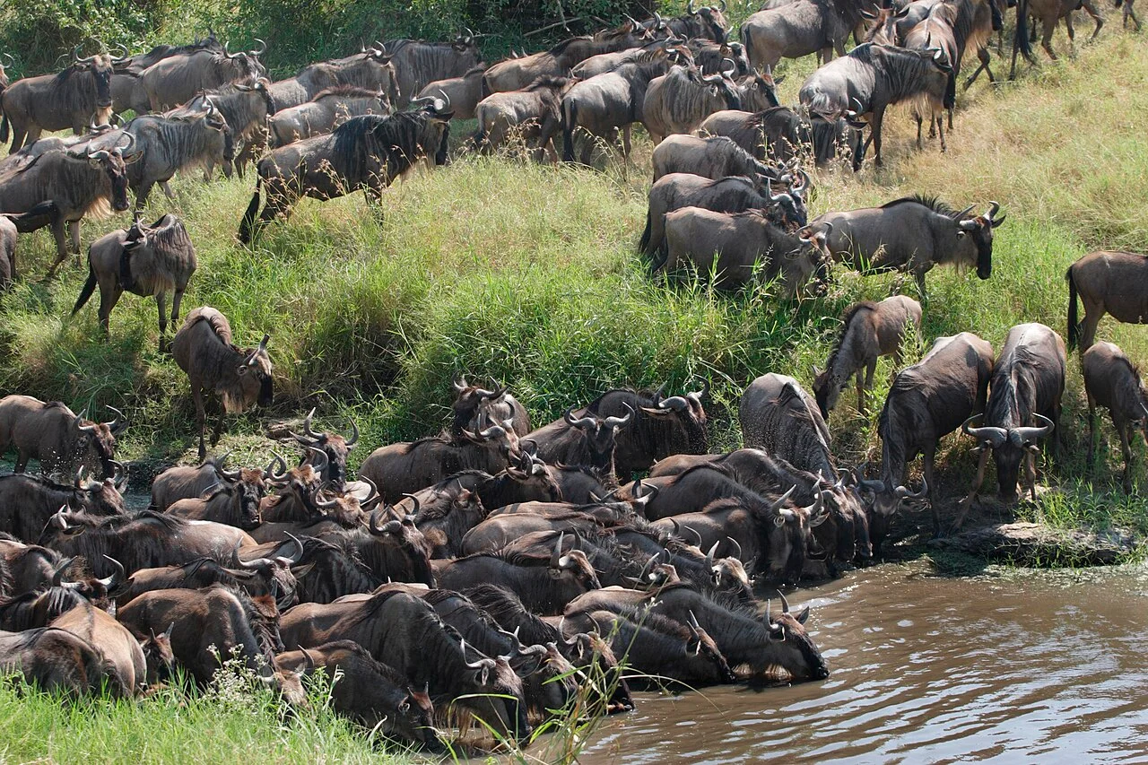
 North Serengeti is one of the most captivating regions of Serengeti National Park in northern Tanzania. Located near the border with Kenya and extending toward the Mara River and the Lamai area, this remote wilderness is celebrated for its dramatic landscapes, abundant wildlife, and connection to the annual Great Wildebeest Migration. Unlike the wide, open plains of southern and central Serengeti, North Serengeti features rolling hills, granite kopjes, acacia woodlands, riverine vegetation, valleys, and open savannah. This varied environment creates habitats for a wide range of wildlife, including elephants, lions, leopards, cheetahs, buffaloes, giraffes, zebras, wildebeest, topi, gazelles, hippos, hyenas, and numerous bird species. The region is especially famous for the Mara River, where migrating wildebeest and zebras may attempt to cross during their seasonal movement through the Serengeti-Mara ecosystem. These crossings are among Africa’s most dramatic wildlife spectacles, but they are entirely natural and unpredictable. Animals may gather at the river for hours or days, change direction, or decide not to cross at all. North Serengeti also includes the Lobo Valley, an area known for its rocky scenery, resident wildlife, and opportunities to observe large predators. The region’s relative remoteness can provide a quieter safari atmosphere, although visitor numbers may increase around popular migration periods. A North Serengeti safari is ideal for travellers seeking dramatic wildlife encounters, photography opportunities, remote landscapes, and a deeper exploration of Tanzania’s northern safari circuit. TanzaLux Safaris can design a private safari that combines North Serengeti with Central Serengeti, Ngorongoro Crater, Tarangire National Park, or other destinations according to the season and your interests.
Wildlife
Wildebeest & Zebra
Landscape
Wildlife Safari / Great Migration / Mara River / Big Five Safari / Luxury Safari / Remote Wilderness / Photography / Game Drives
Highlights
Experience the remote wilderness of northern Serengeti
 Southern Circuit / Morogoro & Iringa Regions / Tanzania
Udzungwa Mountains National Park: Rainforest, Waterfalls and Walking Adventures Udzungwa brings a different rhythm to a Tanzania safari. Here, the journey unfolds at walking pace: a monkey moves through the canopy, water echoes through a shaded gorge, and an uphill trail opens onto the wide Kilombero Valley. For travelers who enjoy being active outdoors, the park offers a rewarding combination of forest scenery, waterfall hikes, birdwatching and exceptional biodiversity. The protected area covers approximately 1,990 square kilometres and was established in 1992. It belongs to the Eastern Arc Mountains, an ancient chain celebrated for distinctive forest habitats and species with restricted ranges. Udzungwa is particularly appealing when paired with Mikumi: open-country wildlife viewing and a forest walk give the same journey two very different experiences. Location and the Main Visitor Gateway The park extends across Morogoro and Iringa Regions. Most first-time visitors use the eastern side around Mang’ula, close to the Kilombero Valley. This gateway is reached through the Mikumi–Kidatu–Mang’ula corridor. The park itself is extensive, and an itinerary based at Mang’ula does not mean that every remote mountain or forest block can be visited on a single excursion. Choose accommodation and transfers around the trail you actually want to walk. The name of a lodge or a broad regional map can conceal a substantial transfer to the starting point. A good plan identifies the correct entrance, registration arrangements, guide, walking route and return transport before departure. Why the Forest Is Special Udzungwa protects a remarkable transition from lower woodland and forest to mountain vegetation. Bamboo, moist forest, streams and higher slopes form a varied landscape rather than one uniform stretch of rainforest. Elevation, shade and exposure change the atmosphere as you walk, and even a modest excursion can reveal differences in leaves, bird calls and the feel of the air. Its conservation value reaches beyond attractive scenery. Forest cover protects water catchments, while connected habitats support species that depend on a limited part of the Eastern Arc. Visiting with care means valuing the entire environment: the understory, fallen wood, stream edges and small organisms are part of the experience, not background to a waterfall photograph. Sanje Waterfalls: The Signature Hike Sanje is the park’s best-known walking attraction. Its cascades descend through forest, with the major drop commonly described as about 170 metres. The visit can include different viewpoints and waterfall levels according to the route selected and the day’s conditions. The image featured here shows the middle waterfall; it should not be confused with a photograph of the tallest drop. Allow a substantial part of the day for the excursion, even when the walking route is described as a half-day hike. Registration, transfers, uphill sections, water breaks, nature observation and a relaxed return all take time. Ask whether the planned walk includes the lower viewpoint, upper cascades or a longer circuit, because these choices affect both effort and duration. The route deserves proper walking preparation. A short distance on a map can still mean sustained climbing, uneven steps, roots and damp ground. Walk at a steady pace, keep enough time for the descent and tell the guide when you need a break. Reaching a viewpoint comfortably is more enjoyable than rushing to fit too many activities into the same day. Short Walks and Longer Treks Udzungwa offers more than Sanje. Shorter forest outings, including the Sonjo area, can suit visitors who want nature observation without committing to a long waterfall climb. Longer routes associated with Mwanihana and Lumemo appeal to experienced walkers seeking a deeper forest journey. Their availability, condition and logistical requirements must be confirmed with park staff before they become part of an itinerary. Treat a multi-day trek as a separate expedition. It requires an agreed route, approved camping, appropriate support, food and water planning, equipment and realistic daily stages. A summit name or an old trail map is not evidence that a route is currently open. The safest and most rewarding choice is the route that matches current park guidance, the group’s ability and the weather. Primates and Wildlife Expectations The Udzungwa red colobus, also known as the Iringa red colobus, and the Sanje mangabey are flagship primates of the Udzungwa landscape. Blue monkeys and vervet monkeys also occur in the park. Their presence makes forest walking especially interesting, but no particular species can be guaranteed on a chosen trail or at a scheduled time. A worthwhile wildlife walk leaves room to listen and wait. Look into the canopy as well as along the path, and let the guide identify movement before approaching. Keep quiet around animals, allow them space and never offer food. A sighting is most memorable when you can watch natural behavior without changing it. Larger mammals occur in different parts of this extensive protected area, but a normal Sanje visit should be planned around forest biodiversity. Travelers hoping for regular elephant, lion or other savanna wildlife encounters should include a suitable game-viewing park elsewhere in their safari. Udzungwa adds another dimension to that experience through walking, primates and forest habitats. Birdwatching and Small Discoveries More than 400 bird species have been recorded in the park. Forest specialists, greenbuls, sunbirds and raptors contribute to its appeal for birdwatchers. A park-wide species list reflects many habitats and years of observation; it is not a prediction of what a visitor will see on one morning’s walk. For a dedicated birding visit, explain your interests when booking and allow time for patient observation. Binoculars are useful even when the main purpose of the trip is hiking. A waterfall walk becomes richer when you also notice butterflies, forest plants, amphibians and small movements in the understory. Avoid handling animals or disturbing vegetation to improve a photograph. Best Time to Visit June to October generally provides the easiest hiking conditions. Wetter months bring greener vegetation and may produce stronger waterfall flows, while increasing the chance of mud, slippery surfaces and changes to the planned route. Forest weather can vary quickly, and rain protection remains useful throughout the year. Choose the season around your priorities. If comfortable footing matters most, favor the drier period. If you prefer lush scenery and are happy with a flexible schedule, a wetter-season visit may suit you. Do not build an itinerary around guaranteed clear skies or a particular water level: leave room for the guide to adapt the day to conditions. How Long to Stay One full day at the park can provide a satisfying introduction, particularly for a Sanje excursion with comfortable transfers. Staying two or three nights near Mang’ula creates a more relaxed visit, with time for an additional walk, focused birding and recovery after travel. Longer trekking requires extra days beyond an ordinary waterfall stay. For a simple visit, arrive the previous afternoon, settle in and prepare your equipment. Walk after breakfast the next day, carry lunch if required and return with time to rest. With an additional day, choose a shorter nature outing or another confirmed route rather than automatically adding a second strenuous climb. These are planning suggestions, and the final schedule should reflect your pace. Getting There and Combining Destinations Dar es Salaam is the main international gateway for many southern Tanzania journeys. Road access commonly runs through Morogoro and Mikumi before continuing toward Kidatu and Mang’ula. Build generous time into the transfer and confirm conditions close to departure. City traffic, stops, roadworks and the exact accommodation location can change the journey substantially. A road journey from Dar es Salaam deserves a travel day; a rushed return excursion with a major hike gives little margin. Mikumi is the most practical nearby safari combination. Ruaha or Nyerere can be added to a longer southern itinerary after checking the distances and current transfer options. Air arrangements should be based on confirmed services and a realistic road connection to the park, rather than assumed direct flights. Accommodation, Camping and Budgeting Mang’ula and the surrounding gateway area offer places to stay outside the park. Confirm the room facilities, meal arrangements, packed lunch, transport to the trailhead and any equipment you expect to hire. An early breakfast and reliable transfer are often more useful for a hiking trip than a long list of hotel amenities. Camping is possible through approved park arrangements. Remote or special campsites require advance planning, and facilities should be checked rather than assumed. Ask for an itemized trip quotation covering entry, guide or ranger services, any trekking and camping charges, transport, meals and accommodation. Applicable fees depend on visitor category and the chosen activities, so use the current quotation for your budget. Fitness, Families and Accessibility A comfortable Sanje visit requires enough fitness for uphill walking and a controlled descent over uneven ground. Explain any mobility limitations when planning the trip so that the route can be assessed realistically. Forest paths and waterfall approaches should not be assumed to offer step-free or wheelchair access. Families can enjoy the park when walking expectations match the children’s stamina and confidence. Choose an achievable route, make frequent breaks and keep children close on slippery sections and near water. A shorter, relaxed nature walk can be more rewarding than completing a challenging route under pressure. The guide should help choose the experience around the group’s needs. What to Bring and How to Visit Responsibly Wear walking shoes with good grip and bring water, snacks or a packed lunch, a light rain layer, sun protection, insect repellent and a small daypack. Binoculars and a camera are useful additions; protect electronics from spray and rain. For longer walks, agree water quantities, equipment and carrying arrangements with the guide beforehand. Stay on authorized trails and follow guide and ranger instructions. Leave plants, rocks and animals where you find them, take all litter out and avoid loud music. Swimming should only be considered in an officially permitted place when the guide confirms conditions are safe; the existence of a pool is not permission to enter it. Water flow and footing can change after rain. Plan Your Udzungwa Visit with TanzaLux Safaris Start with the experience you want: a memorable waterfall hike, a gentle forest introduction, focused birdwatching or an extended trek. Share your travel dates, available time and walking ability so that accommodation, transfers and the right route can be arranged together. Udzungwa rewards a thoughtful schedule that leaves time to observe, pause and enjoy the forest.
Wildlife
Udzungwa red colobus & Sanje mangabey
Landscape
National Park / Rainforest / Hiking & Trekking / Waterfalls / Primate Watching / Birdwatching / Biodiversity Hotspot / Eastern Arc Mountains / Photography / Southern Tanzania Safari Circuit
Highlights
Sanje Waterfall